1
Apex Park entrance
This way to the old brickworks lakes. It's also a cycle path and part of National Route 33.
Image: © Neil Owen
Taken: 13 Aug 2013
0.03 miles
2
The end of the route, the beginning of the road
The cycle path through Apex Park stops here, although Route 33 carries on into town.
Image: © Neil Owen
Taken: 13 Aug 2013
0.04 miles
3
Waiting for a new occupant
A small industrial estate alongside the seafront, silent for now.
Image: © Neil Owen
Taken: 13 Aug 2013
0.04 miles
4
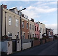
Georgian-style houses in Clyce Road, Highbridge
This small row of houses looks Georgian, but may be only in the Georgian style.
There is no Listed Building entry for Clyce Road. The house name in view on the left is Backabit Cottage.
Image: © Jaggery
Taken: 10 Dec 2014
0.12 miles
5
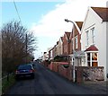
Houses and riverbank, Clyce Road, Highbridge
The cars are parked alongside railings at the edge of the River Brue.
Image: © Jaggery
Taken: 10 Dec 2014
0.12 miles
6
Highbridge : Clyce Road
Looking along Clyce Road in Highbridge.
Image: © Lewis Clarke
Taken: 24 Feb 2018
0.13 miles
7
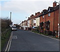
East along Clyce Road, Highbridge
Looking towards Huntspill Road from the edge of New Clyce Bridge over the River Brue. http://www.geograph.org.uk/photo/4399997
Image: © Jaggery
Taken: 10 Dec 2014
0.13 miles
8
The Globe Inn
An old two storey type of pub in Newtown Road.
Image: © Neil Owen
Taken: 13 Aug 2013
0.13 miles
9
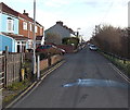
Eastern end of Clyce Road, Highbridge
Viewed from the A38 Huntspill Road end. Clyce Road is a 450 metre long dead-end street. The houses are all on one side, opposite the River Brue. New Clyce Bridge is at the far end of the road. Clyce is a local word for a sluice or lock.
Image: © Jaggery
Taken: 10 Dec 2014
0.13 miles
10
Clyce Road, Highbridge
Viewed across Huntspill Road. Clyce Road is a 450 metre long dead-end street along a bank
of the River Brue. New Clyce Bridge is at the far end. Clyce is a local word for a sluice or lock.
Image: © Jaggery
Taken: 10 Dec 2014
0.14 miles


