1
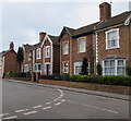
The Limes, Church Street, Bridgwater
The name sign shows THE LIMES REST HOME FOR ELDERLY GENTLEFOLK.
Image: © Jaggery
Taken: 3 Apr 2017
0.01 miles
2
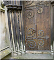
Queen Elizabeth II postbox in a churchyard wall, Bridgwater
Located here. http://www.geograph.org.uk/photo/5335869
Image: © Jaggery
Taken: 3 Apr 2017
0.01 miles
3
Information board, St John the Baptist, Bridgwater
On the corner of Blake Place and Church Street, at the southwest edge
of the churchyard of the Parish Church of St John the Baptist. http://www.geograph.org.uk/photo/5335811
Image: © Jaggery
Taken: 3 Apr 2017
0.02 miles
4
Churchyard perimeter wall, Church Street, Bridgwater
The wall is at the western edge of the churchyard of the Parish Church of St John the Baptist. http://www.geograph.org.uk/photo/5335811
Image: © Jaggery
Taken: 3 Apr 2017
0.02 miles
5
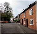
Junction of Church Street and Blake Place, Bridgwater
The houses are in Church Street.
Image: © Jaggery
Taken: 3 Apr 2017
0.02 miles
6
One-way signs, Blake Place, Bridgwater
Viewed from the corner of Church Street. The one-way street Blake Place
extends eastwards for 120 metres to the A38 Monmouth Street.
Image: © Jaggery
Taken: 3 Apr 2017
0.03 miles
7
Location of OS Published Abstract Bolt - Bridgwater, St John's Church
Image: © thejackrustles
Taken: 25 Apr 2022
0.03 miles
8
Ordnance Survey 1GL Bolt
This OS Bolt can be found on the SW face of St John's Church. It marks a point 7.9602m above mean sea level.
Image: © Adrian Dust
Taken: 24 Nov 2014
0.03 miles
9
Obey this sign and end up in The Clink
Contradictory sign, bourne of slight libralisation of cycling regulations in recent years. No cycling on the cycle path!
Thank goodness I was walking.
Image: © Richard Webb
Taken: 31 Mar 2012
0.03 miles
10
Short row of houses, Church Street, Bridgwater
At the northern end of Church Street.
Image: © Jaggery
Taken: 3 Apr 2017
0.03 miles


