IMAGES TAKEN NEAR TO
Rodway, BRIDGWATER, TA5 2SU
Introduction
This page details the photographs taken nearby to Rodway, TA5 2SU by members of the Geograph project.
The Geograph project started in 2005 with the aim of publishing, organising and preserving representative images for every square kilometre of Great Britain, Ireland and the Isle of Man.

There are currently over 7.5m images from over14,400 individuals and you can help contribute to the project by visiting https://www.geograph.org.uk
Image Map
Images are licensed for reuse under creativecommons.org/licenses/by-sa/2.0
Notes
- Clicking on the map will re-center to the selected point.
- The higher the marker number, the further away the image location is from the centre of the postcode.
Image Listing (21 Images Found)
Images are licensed for reuse under creativecommons.org/licenses/by-sa/2.0
Image
Details
Distance
1
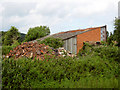
Buildings at Cannington
Part of Bridgwater College's Cannington Centre for Land Based Studies, by footpath BW 5/4.
Image: © Derek Harper
Taken: 16 Apr 2011
0.05 miles
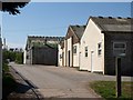
2
The Downs, Cannington
Cannington has a long history of education for the agricultural sciences. Various organisations and buildings occupy the land to the north and form part of Cannington College. It opened its classes in 1921 and merged with Bridgwater and Taunton College in 2004 to offer land-based courses.
Image: © Neil Owen
Taken: 19 Aug 2021
0.07 miles
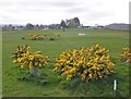
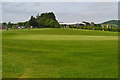
5
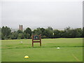
The second tee and St Mary's
The golf course occupies a slightly higher ground than the village; beyond the mist and drizzle swirls around the Quantock Hills. Best keep a brolly in the bag.
Image: © Neil Owen
Taken: 19 Aug 2021
0.11 miles
6
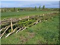
Laid hedge, Cannington
A example of hedge-laying beside footpath BW 5/4, courtesy of the Department of Countryside Management at Bridgwater College.
Image: © Derek Harper
Taken: 16 Apr 2011
0.12 miles
7
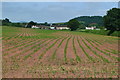
Lines of new shoots, looking towards Rodway
Image: © David Martin
Taken: 28 May 2017
0.12 miles
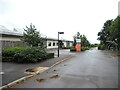
8
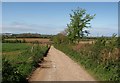
Track at Cannington
Footpath BW 5/4 follow this track, turning right at the building in the valley and heading out across the levels to the Parrett estuary. Rodway Farm, on the extreme left, is in Image
Image: © Derek Harper
Taken: 16 Apr 2011
0.16 miles
9
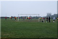
Cannington Football Ground
Image: © Adrian and Janet Quantock
Taken: 19 Feb 2006
0.17 miles