IMAGES TAKEN NEAR TO
Franklin Close, TAUNTON, TA2 6TT
Introduction
This page details the photographs taken nearby to Franklin Close, TA2 6TT by members of the Geograph project.
The Geograph project started in 2005 with the aim of publishing, organising and preserving representative images for every square kilometre of Great Britain, Ireland and the Isle of Man.

There are currently over 7.5m images from over14,400 individuals and you can help contribute to the project by visiting https://www.geograph.org.uk
Image Map
Images are licensed for reuse under creativecommons.org/licenses/by-sa/2.0
Notes
- Clicking on the map will re-center to the selected point.
- The higher the marker number, the further away the image location is from the centre of the postcode.
Image Listing (35 Images Found)
Images are licensed for reuse under creativecommons.org/licenses/by-sa/2.0
Image
Details
Distance
1
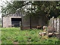
Farmyard near Taunton
A family of pheasants seems to have got mixed up with the sheep in this farmyard on Mill Rise.
Image: © Derek Harper
Taken: 25 Aug 2009
0.05 miles
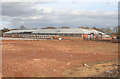
2
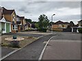
Taunton: Silk Meadows
New housing under construction by the A306. Seen from the junction with Great Western Way, foreground
Image: © Martin Bodman
Taken: 18 Jun 2012
0.06 miles
3
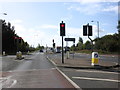
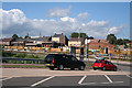
The A3065 bypass, to the west of Taunton
Image: © Roger Cornfoot
Taken: 22 Sep 2011
0.10 miles
4
The Ministry of Cake
This is presumably a cake bakery. It sits on Frobisher Way , just off Bindon Rd on an industrial estate.
Image: © Nigel Mykura
Taken: 4 Apr 2016
0.11 miles
5
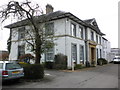
Consultancy building, Nuffield Hospital, Taunton
Image: © Roger Cornfoot
Taken: 28 Oct 2010
0.15 miles
6
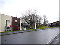
Norton Fitzwarren: Store Shed 1h
A remnant of the large Second World War US Army stores complex, now used for other purposes. On the edge of the Langford Mead development. See Image] for more detail
Image: © Martin Bodman
Taken: 18 Jun 2012
0.15 miles
7
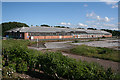
Norton Fitzwarren: World War II supply depot (part)
Store Shed 1h is one of the few survivors of a major complex at Norton, erected in 1940-1 for the Royal Army Service Corps. The site was taken over by the US Army in 1942, prior to the Normandy invasion, and was then listed at General Depot G-50, one of 18 in the country. It consisted of warehouses, rail sheds and marshalling yards and eventually closed in 1966. To the north, part of the site, at Burnshill, had been utilised as a camp for Italian and later for German prisoners. The western end of the complex was built over after the war. In 2010 the remaining estate is being re-developed as a business park, now known as Langford Mead
Image: © Martin Bodman
Taken: 21 Mar 2010
0.15 miles
8

Mobile MRI scanning unit, parked at Nuffield Hospital, Taunton
Image: © Roger Cornfoot
Taken: 28 Oct 2010
0.15 miles