IMAGES TAKEN NEAR TO
Bilbrook, MINEHEAD, TA24 6HB
Introduction
This page details the photographs taken nearby to TA24 6HB by members of the Geograph project.
The Geograph project started in 2005 with the aim of publishing, organising and preserving representative images for every square kilometre of Great Britain, Ireland and the Isle of Man.

There are currently over 7.5m images from over14,400 individuals and you can help contribute to the project by visiting https://www.geograph.org.uk
Image Map
Images are licensed for reuse under creativecommons.org/licenses/by-sa/2.0
Notes
- Clicking on the map will re-center to the selected point.
- The higher the marker number, the further away the image location is from the centre of the postcode.
Image Listing (10 Images Found)
Images are licensed for reuse under creativecommons.org/licenses/by-sa/2.0
Image
Details
Distance
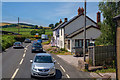
1
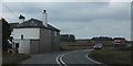
Bend in the road west of Bilbrook
Sheep grazing on the fields by the A39
Image: © David Smith
Taken: 12 Mar 2013
0.01 miles
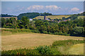
3
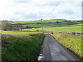
Sandhill Lane
Looking south from near the A39 towards Sandhill Farm, with the Brendon Hills rising in the background.
Image: © Jonathan Billinger
Taken: 17 Dec 2009
0.11 miles
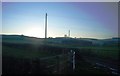
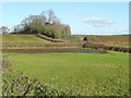
4
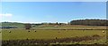
View north-east of the A39
Looking towards the tower of St. Andrew's church, Old Cleeve nestling at the foot of Claydowns Hill.
Image: © Jonathan Billinger
Taken: 17 Dec 2009
0.13 miles
5
Bilbrook : The A39
Heading through Bilbrook on the A39.
Image: © Lewis Clarke
Taken: 12 Jul 2019
0.13 miles
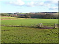
6
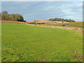
Withycombe : Grassy Field
Looking out across a grassy field in the countryside in the parish of Withycombe. Beyond you can see the church tower of St Andrew's in Old Cleeve on the hillside.
Image: © Lewis Clarke
Taken: 12 Jul 2019
0.19 miles
7
View north of the A39
Opposite the turn for Sandhill Lane.
Image: © Jonathan Billinger
Taken: 17 Dec 2009
0.19 miles
8
Old Cleeve : Grassy Field
Countryside in the Old Cleve parish.
Image: © Lewis Clarke
Taken: 12 Jul 2019
0.19 miles
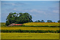
10
Pasture by the A39
Looking north-west from Sandhill Lane, the woods in view are Withycombe Wood, left, and Leggar Copse, more distant right.
Image: © Jonathan Billinger
Taken: 17 Dec 2009
0.23 miles