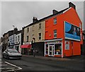
IMAGES TAKEN NEAR TO
South Street, TAUNTON, TA1 3FD

Introduction

This page details the photographs taken nearby to South Street, TA1 3FD by members of the Geograph project.

The Geograph project started in 2005 with the aim of publishing, organising and preserving representative images for every square kilometre of Great Britain, Ireland and the Isle of Man.

There are currently over 7.5m images from over14,400 individuals and you can help contribute to the project by visiting https://www.geograph.org.uk

Image Map


Images are licensed for reuse under creativecommons.org/licenses/by-sa/2.0
Notes
  • Clicking on the map will re-center to the selected point.
  • The higher the marker number, the further away the image location is from the centre of the postcode.

Image Listing (150 Images Found)

Images are licensed for reuse under creativecommons.org/licenses/by-sa/2.0
  • ...
Image
Details
Distance
1
South Street, Taunton
Looking up the one-way street from its junction with Image This would probably have once been the main road to Langport.
Image: © Derek Harper Taken: 10 Jan 2008
0.02 miles
2
South Street - Taunton
Image: © Nick Chipchase Taken: 11 May 2009
0.02 miles
3
Small reminder
This unassuming motif and sign are all that remains to remind passers-by that this used to be a chapel. See Image] for a wider view.
Image: © Neil Owen Taken: 16 Jul 2013
0.03 miles
4
Our Lady has left the building
The former church of Our Lady of Glastonbury, now residential homes. See Image] for a clue as to the past of this place of worship.
Image: © Neil Owen Taken: 16 Jul 2013
0.03 miles
5
No longer in service
The old Naval and Military pub in East Reach - having been closed down and de-licensed some time ago it is now looking ripe for a complete redevelopment.
Image: © Neil Owen Taken: 16 Jul 2013
0.04 miles
6
JKS Flooring, Taunton
Well and truly Tangoed!
Image: © Roger Cornfoot Taken: 21 Dec 2016
0.04 miles
7
Naval and Military Inn at Taunton
Now semi derelict.
Image: © Nick Chipchase Taken: 11 Jan 2012
0.04 miles
8
Gray's Almshouses, Taunton
Taken during their renovation.
Image: © Chris Andrews Taken: Unknown
0.04 miles
9
East Reach, Taunton
This road stretches eastward from the centre of Taunton across the town's transition zone, and, thanks to a lack of attention from developers, still preserves C18 and C19 buildings. This row, containing premises experiencing a range of economic fortune, is opposite the junction with South Street. In the centre is Image To its left are buildings described at http://webapp1.somerset.gov.uk/her/details.asp?prn=45959 .
Image: © Derek Harper Taken: 10 Jan 2008
0.04 miles
10
Naval and Military Inn, Taunton
In need of a lick of paint, but let's hope they preserve the fine lettering and inn sign. Some architectural detail is at http://webapp1.somerset.gov.uk/her/details.asp?prn=45960 . The traffic light is at the junction with Image
Image: © Derek Harper Taken: 10 Jan 2008
0.04 miles
  • ...