IMAGES TAKEN NEAR TO
Mare Lane, SOUTH PETHERTON, TA13 5LY
Introduction
This page details the photographs taken nearby to Mare Lane, TA13 5LY by members of the Geograph project.
The Geograph project started in 2005 with the aim of publishing, organising and preserving representative images for every square kilometre of Great Britain, Ireland and the Isle of Man.

There are currently over 7.5m images from over14,400 individuals and you can help contribute to the project by visiting https://www.geograph.org.uk
Image Map
Images are licensed for reuse under creativecommons.org/licenses/by-sa/2.0
Notes
- Clicking on the map will re-center to the selected point.
- The higher the marker number, the further away the image location is from the centre of the postcode.
Image Listing (52 Images Found)
Images are licensed for reuse under creativecommons.org/licenses/by-sa/2.0
Image
Details
Distance
1
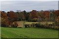
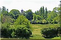
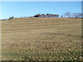
East Lambrook to South Petherton Footpath
This is the footpath at the South Petherton end. It runs parallel to the hedge on
the right, passes through the lower gate and then through the further gate. It then becomes a track called Mare Lane. That name has also been adopted for a road of old people's bungalows which now runs parallel to the lane.
Image: © Andy Pearce
Taken: 14 Nov 2008
0.06 miles
2
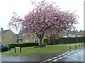
Cherry Tree at Stoodham
This ornamental cherry tree was one of several on the estate.
The others have been lost to parking spaces or the weather.
One was blown down only a few days before this picture was taken.
Image: © Andy Pearce
Taken: 29 Apr 2008
0.07 miles
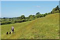
6

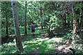
Footpath near Manor at South Petherton
Image: © Nick Chipchase
Taken: 19 Jun 2015
0.11 miles
9
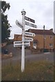
Old Direction Sign - Signpost by Silver Street, South Petherton
Pyramid finial - 4 arms; Somerset SCC pyramid (Sheldon) by the UC road, in parish of South Petherton (South Somerset District), Silver Street junction with Lightgate Road.
Surveyed
Milestone Society National ID: SO_ST4317B
Image: © Milestone Society
Taken: Unknown
0.13 miles
10
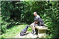
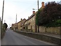
Mere Linches
This is known by the locals as "Mary Lenseys"
Image: © Andy Pearce
Taken: 5 Dec 2007
0.16 miles