IMAGES TAKEN NEAR TO
Curry Rivel, LANGPORT, TA10 0PD
Introduction
This page details the photographs taken nearby to TA10 0PD by members of the Geograph project.
The Geograph project started in 2005 with the aim of publishing, organising and preserving representative images for every square kilometre of Great Britain, Ireland and the Isle of Man.

There are currently over 7.5m images from over14,400 individuals and you can help contribute to the project by visiting https://www.geograph.org.uk
Image Map (Loading...)


Getting Data...Please wait
Leaflet Map data © OpenStreetMap
Images are licensed for reuse under creativecommons.org/licenses/by-sa/2.0
Notes
- Clicking on the map will re-center to the selected point.
- The higher the marker number, the further away the image location is from the centre of the postcode.
Image Listing (12 Images Found)
Images are licensed for reuse under creativecommons.org/licenses/by-sa/2.0
Image
Details
Distance
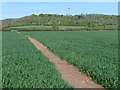
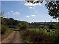
3
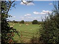
Field beside South Drove
Looking past rose hips through a gateway opposite the start of Image Beyond the ploughed field, on the hilltop, is Image
Image: © Derek Harper
Taken: 15 Sep 2007
0.17 miles
4
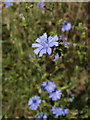
Chicory
Cichorium intybus growing in a corner of the field shown in Image
Image: © Derek Harper
Taken: 15 Sep 2007
0.19 miles
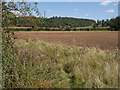
5
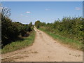
Hatch Drove
One of the many straight tracks that sets out across West Sedge Moor from South Drove.
Image: © Derek Harper
Taken: 15 Sep 2007
0.21 miles
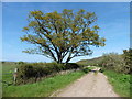
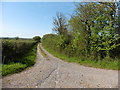
7
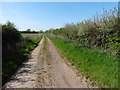
Beercrowcombe Drove from South Drove
The field lies at the edge of West Sedge Moor in the angle between the two tracks. Beercrowcombe Drove heads out northwestwards across the levels; South Drove meanders along the edge of the slope. A good display of haws is evident.
Image: © Derek Harper
Taken: 15 Sep 2007
0.21 miles
9
Beercrowcombe Drove
The Burton Pynsent monument (which I'm sure is leaning to the west) rises on the hilltop above West Sedge Moor, as Beercrowcombe Drove approaches its junction with South Drove.
Image: © Derek Harper
Taken: 15 Sep 2007
0.22 miles