IMAGES TAKEN NEAR TO
Wigmore Road, LUDLOW, SY8 2HW
Introduction
This page details the photographs taken nearby to Wigmore Road, SY8 2HW by members of the Geograph project.
The Geograph project started in 2005 with the aim of publishing, organising and preserving representative images for every square kilometre of Great Britain, Ireland and the Isle of Man.

There are currently over 7.5m images from over14,400 individuals and you can help contribute to the project by visiting https://www.geograph.org.uk
Image Map (Loading...)


Getting Data...Please wait
Leaflet Map data © OpenStreetMap
Images are licensed for reuse under creativecommons.org/licenses/by-sa/2.0
Notes
- Clicking on the map will re-center to the selected point.
- The higher the marker number, the further away the image location is from the centre of the postcode.
Image Listing (15 Images Found)
Images are licensed for reuse under creativecommons.org/licenses/by-sa/2.0
Image
Details
Distance
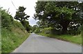
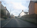
2
Un-named lane junction in Leinthall Starkes
Image: © Stuart Logan
Taken: 22 Sep 2013
0.08 miles
3
Leinthall Starkes (Viewed from Adforton)
Image: © Fabian Musto
Taken: 28 Apr 2023
0.11 miles
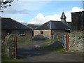
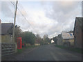
4
Leinthall Starkes - 3
Looking east at the village centre.
Image: © Trevor Rickard
Taken: 24 Nov 2008
0.12 miles
5
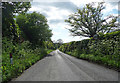
Country road near Leinthall Starkes (1)
Image: © Stephen Richards
Taken: 14 May 2014
0.12 miles
6

Leinthall Starkes
Here is the village of Leinthall Starkes from the ruins of the east tower at Wigmore Castle. The building on the hill is a mock windmill, built during the 2000s. Cf. Image
Image: © Fabian Musto
Taken: 9 Dec 2022
0.13 miles
7
Leinthall Starkes - 2
View east along the village road with Gatley Long Coppice on the right.
Image: © Trevor Rickard
Taken: 24 Nov 2008
0.16 miles
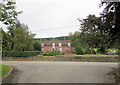
8
Leinthall Starkes - 1
Looking north-east along the village road. Very much a country village as evidenced by the mix of houses and farm buildings.
Image: © Trevor Rickard
Taken: 24 Nov 2008
0.18 miles
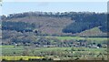
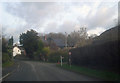
9
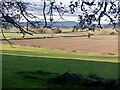
View over the Vale of Wigmore
A glacial era lake bed seen from the Ludlow to Wigmore road.
Image: © Richard Webb
Taken: 21 Nov 2021
0.19 miles