IMAGES TAKEN NEAR TO
Loughton Close, LUDLOW, SY8 1XT
Introduction
This page details the photographs taken nearby to Loughton Close, SY8 1XT by members of the Geograph project.
The Geograph project started in 2005 with the aim of publishing, organising and preserving representative images for every square kilometre of Great Britain, Ireland and the Isle of Man.

There are currently over 7.5m images from over14,400 individuals and you can help contribute to the project by visiting https://www.geograph.org.uk
Image Map (Loading...)


Getting Data...Please wait
Leaflet Map data © OpenStreetMap
Images are licensed for reuse under creativecommons.org/licenses/by-sa/2.0
Notes
- Clicking on the map will re-center to the selected point.
- The higher the marker number, the further away the image location is from the centre of the postcode.
Image Listing (48 Images Found)
Images are licensed for reuse under creativecommons.org/licenses/by-sa/2.0
Image
Details
Distance
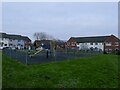
1
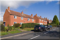
St Margaret Road
Late 1990s/early 2000s? development on the eastern side of Ludlow, within the bypass. In the distance is Titterstone Clee Hill.
Image: © Ian Capper
Taken: 16 Oct 2011
0.03 miles
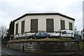
4
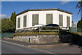
Water Tower
In Clee View. Old maps imply that it dates from the mid-1960s.
Image: © Ian Capper
Taken: 16 Oct 2011
0.14 miles
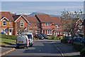
5
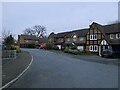
Ballard Close
Houses built on the site of The Riddings farm.
Image: © Richard Webb
Taken: 21 Dec 2021
0.14 miles
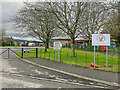
6
Ludlow Primary School
Opened in 1972 when St Lawrence (which I left that year) and Old Street merged. St Lawrence has since returned as a separate entity with a new school built on the Friar's Walk playing field.
Image: © Richard Webb
Taken: 14 Jan 2022
0.14 miles
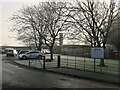
7
Ludlow Primary School
Primary school on Downton View, one of two sites for the school.
Image: © Ian Capper
Taken: 28 Dec 2021
0.15 miles
8
Riddings Road
Part of the council housing development of this part of Ludlow in the 1960s. Old maps show it to be along the route of Rock Lane, a track leading from Lower Galdeford to Rock Farm, only the lower part of which has retained the original name.
Image: © Ian Capper
Taken: 16 Oct 2011
0.15 miles
9
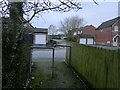
Path, Vashon Close
The barriers keep pesky wheelchairs and pushchairs away. They are particularly nasty around here and the houses and paths only date back to the 1980s - somebody should have known better.
Image: © Richard Webb
Taken: 21 Dec 2021
0.15 miles