IMAGES TAKEN NEAR TO
Lingen, BUCKNELL, SY7 0EB
Introduction
This page details the photographs taken nearby to SY7 0EB by members of the Geograph project.
The Geograph project started in 2005 with the aim of publishing, organising and preserving representative images for every square kilometre of Great Britain, Ireland and the Isle of Man.

There are currently over 7.5m images from over14,400 individuals and you can help contribute to the project by visiting https://www.geograph.org.uk
Image Map
Images are licensed for reuse under creativecommons.org/licenses/by-sa/2.0
Notes
- Clicking on the map will re-center to the selected point.
- The higher the marker number, the further away the image location is from the centre of the postcode.
Image Listing (10 Images Found)
Images are licensed for reuse under creativecommons.org/licenses/by-sa/2.0
Image
Details
Distance
1
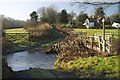
Ford at Lower Yeld
This ford is found at Lower Yeld near to Deerfield Bridge.
Image: © John Walton
Taken: 28 Dec 2014
0.04 miles
2
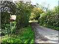
Road junction at Lower Lye
Road junction at Lower Lye in the Lugg valley.
Image: © Philip Halling
Taken: 16 Oct 2019
0.07 miles
3
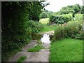
Ford at Lower Yeld
There is an old footbridge just to the right
Image: © Raymond Perry
Taken: 24 Aug 2003
0.08 miles
6
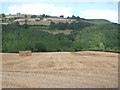
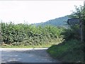
Fields, Limebrook Wood and the hill beyond
looking north-east from the road between Kinsham and Lingen
Image: © Andrew Longton
Taken: 24 Aug 2005
0.20 miles
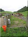
7
Liverstock pens
Pens for containing livestock beside the road near Deerfold. Richard Webb photographed these same pens back in 2007 Image
Image: © Philip Halling
Taken: 16 Oct 2019
0.20 miles
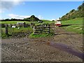
8
Gathering pens, Deerfold
A typical dry valley in the soft chalk like Silurian Limestone. Beyond the pens, a farmer is inspecting his flock.
Image: © Richard Webb
Taken: 25 Jul 2007
0.21 miles
9
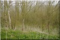
Young woodland near Deerfold
On steep slopes below the road.
Image: © Richard Webb
Taken: 15 Apr 2016
0.21 miles
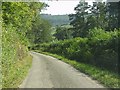
10
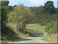
Lane near Pritchard's Wood
The salt bin attests to the switchback profile of the lane over a ridge.
Image: © Peter Whatley
Taken: 1 Sep 2011
0.24 miles