IMAGES TAKEN NEAR TO
Stanford, Halfway House, SHREWSBURY, SY5 9DS
Introduction
This page details the photographs taken nearby to SY5 9DS by members of the Geograph project.
The Geograph project started in 2005 with the aim of publishing, organising and preserving representative images for every square kilometre of Great Britain, Ireland and the Isle of Man.

There are currently over 7.5m images from over14,400 individuals and you can help contribute to the project by visiting https://www.geograph.org.uk
Image Map (Loading...)


Getting Data...Please wait
Leaflet Map data © OpenStreetMap
Images are licensed for reuse under creativecommons.org/licenses/by-sa/2.0
Notes
- Clicking on the map will re-center to the selected point.
- The higher the marker number, the further away the image location is from the centre of the postcode.
Image Listing (4 Images Found)
Images are licensed for reuse under creativecommons.org/licenses/by-sa/2.0
Image
Details
Distance
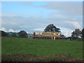
2
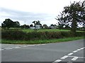
Unclassified roads at Stanford
The tiny hamlet of Stanford consists of a few farms scattered in the near vicinity.
Image: © Anne
Taken: 27 Aug 2007
0.15 miles
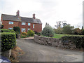
4
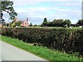
Hole Farm
A rural setting for some contented grazing in Shropshire
Image: © Anne
Taken: 27 Aug 2007
0.20 miles