IMAGES TAKEN NEAR TO
Cross Houses, SHREWSBURY, SY5 6JR
Introduction
This page details the photographs taken nearby to SY5 6JR by members of the Geograph project.
The Geograph project started in 2005 with the aim of publishing, organising and preserving representative images for every square kilometre of Great Britain, Ireland and the Isle of Man.

There are currently over 7.5m images from over14,400 individuals and you can help contribute to the project by visiting https://www.geograph.org.uk
Image Map
Images are licensed for reuse under creativecommons.org/licenses/by-sa/2.0
Notes
- Clicking on the map will re-center to the selected point.
- The higher the marker number, the further away the image location is from the centre of the postcode.
Image Listing (12 Images Found)
Images are licensed for reuse under creativecommons.org/licenses/by-sa/2.0
Image
Details
Distance
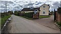
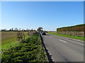
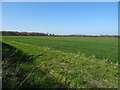
2
A458 View
The A road near Cross Houses.
Image: © Gordon Griffiths
Taken: 11 Mar 2012
0.10 miles
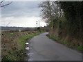
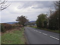
5
A458 towards Shrewsbury
Looking north west near Romanee.
Image: © JThomas
Taken: 28 Mar 2019
0.18 miles
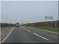
7
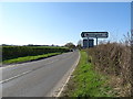
A458 at the junction with the Berrington Road
Looking north west.
Image: © JThomas
Taken: 28 Mar 2019
0.19 miles
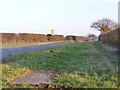
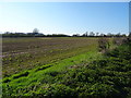
10
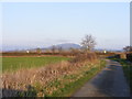
Wrekin View
The view from Berrington lane near the junction with the A458 towards the Shropshire Hill.
Image: © Gordon Griffiths
Taken: 11 Mar 2012
0.22 miles