IMAGES TAKEN NEAR TO
Cressage, SHREWSBURY, SY5 6DQ
Introduction
This page details the photographs taken nearby to SY5 6DQ by members of the Geograph project.
The Geograph project started in 2005 with the aim of publishing, organising and preserving representative images for every square kilometre of Great Britain, Ireland and the Isle of Man.

There are currently over 7.5m images from over14,400 individuals and you can help contribute to the project by visiting https://www.geograph.org.uk
Image Map (Loading...)


Getting Data...Please wait
Leaflet Map data © OpenStreetMap
Images are licensed for reuse under creativecommons.org/licenses/by-sa/2.0
Notes
- Clicking on the map will re-center to the selected point.
- The higher the marker number, the further away the image location is from the centre of the postcode.
Image Listing (5 Images Found)
Images are licensed for reuse under creativecommons.org/licenses/by-sa/2.0
Image
Details
Distance
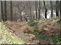
2
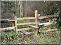
Stile on footpath into Rabbit Warren Plantation
Image: © Row17
Taken: 5 Dec 2007
0.06 miles
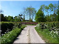
3
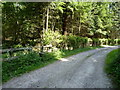
Farm track and footpath in Rabbit Warren Plantation
Image: © Richard Law
Taken: 2 May 2011
0.07 miles
4
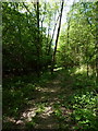
Footpath through Rabbit Warren Plantation
Image: © Richard Law
Taken: 2 May 2011
0.15 miles
5
Footpath and bridleway junction at Belswardyne Hall
Image: © Richard Law
Taken: 2 May 2011
0.20 miles