IMAGES TAKEN NEAR TO
Pontesbury, SHREWSBURY, SY5 0TG
Introduction
This page details the photographs taken nearby to SY5 0TG by members of the Geograph project.
The Geograph project started in 2005 with the aim of publishing, organising and preserving representative images for every square kilometre of Great Britain, Ireland and the Isle of Man.

There are currently over 7.5m images from over14,400 individuals and you can help contribute to the project by visiting https://www.geograph.org.uk
Image Map (Loading...)


Getting Data...Please wait
Leaflet Map data © OpenStreetMap
Images are licensed for reuse under creativecommons.org/licenses/by-sa/2.0
Notes
- Clicking on the map will re-center to the selected point.
- The higher the marker number, the further away the image location is from the centre of the postcode.
Image Listing (23 Images Found)
Images are licensed for reuse under creativecommons.org/licenses/by-sa/2.0
Image
Details
Distance
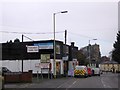
2
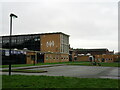
Pontesbury Library
Pontesbury Library with the local school just behind
Image: © Peter Fleming
Taken: 19 Aug 2007
0.04 miles
3
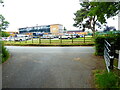
Mary Webb School, Pontesbury
The local senior school.
Image: © Jeremy Bolwell
Taken: 23 Jun 2021
0.06 miles
5
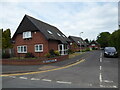
Part of St Georges Gardens in Pontesbury
Nice little cul-de-sac.
Image: © Jeremy Bolwell
Taken: 23 Jun 2021
0.08 miles
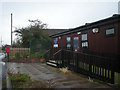
7
Pontesbury Public Hall and the A488 in the village
Image: © David Smith
Taken: 29 Nov 2014
0.14 miles
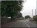
8
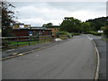
Lane near Pontesbury
Lane near the Mary Webb School, Pontesbury.
Image: © Jeremy Bolwell
Taken: 23 Jun 2021
0.15 miles
9
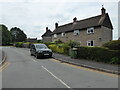
Part of Linley Avenue in Pontesbury.
Nice old homes.
Image: © Jeremy Bolwell
Taken: 23 Jun 2021
0.15 miles
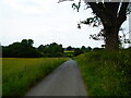
10
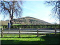
Pontesford Hill
A lovely hill that is different from every angle.
Image: © Jeremy Bolwell
Taken: 6 Apr 2015
0.16 miles