IMAGES TAKEN NEAR TO
Weston, SHREWSBURY, SY4 5RY
Introduction
This page details the photographs taken nearby to SY4 5RY by members of the Geograph project.
The Geograph project started in 2005 with the aim of publishing, organising and preserving representative images for every square kilometre of Great Britain, Ireland and the Isle of Man.

There are currently over 7.5m images from over14,400 individuals and you can help contribute to the project by visiting https://www.geograph.org.uk
Image Map
Images are licensed for reuse under creativecommons.org/licenses/by-sa/2.0
Notes
- Clicking on the map will re-center to the selected point.
- The higher the marker number, the further away the image location is from the centre of the postcode.
Image Listing (13 Images Found)
Images are licensed for reuse under creativecommons.org/licenses/by-sa/2.0
Image
Details
Distance
1
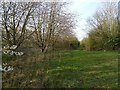
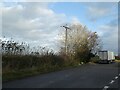
Beside the A49
A grassy track runs parallel to the improved section of road at the west end of Weston Heath.
Image: © Richard Webb
Taken: 30 Mar 2019
0.02 miles
2
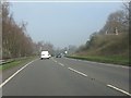
A49 looking south
This is where the road passes through a deep cutting into New Red Sandstone. The cutting replaced an extremely dangerous corner around the outcrop of rock.
Image: © Bob Bowyer
Taken: 18 Sep 2005
0.08 miles
3
Beside the A49
A grassy track runs parallel to the improved section of road at the west end of Weston Heath.
Image: © Richard Webb
Taken: 30 Mar 2019
0.09 miles
4
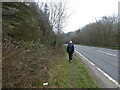
Path approaching the A49 north of Lee Brockhurst
The busy road is intrusive after a quiet country walk.
Image: © Jeremy Bolwell
Taken: 7 Feb 2021
0.10 miles
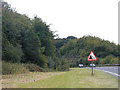
5
Lay-by on A49 near Wixhill
This lay-by appears to be the result of the realignment of the A49 to simplify a bend
Image: © David Smith
Taken: 4 Dec 2021
0.11 miles
7

Layby on the northbound A49 near Weston
Image: © David Dixon
Taken: 21 Sep 2022
0.12 miles
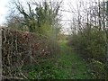
8
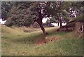
Footpath off the A49, Weston under Redcastle
This path looks rather like an old 'hollow-way' lane, although it is only shown as a footpath on the 1850 map. It leads to Slade 800m to the east.
Image: © Humphrey Bolton
Taken: 19 Jun 2000
0.14 miles
9
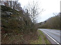
Walking beside the A49 road with old red sandstone hills to our left
The rock is impressive.
Image: © Jeremy Bolwell
Taken: 7 Feb 2021
0.17 miles
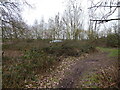
10
Footpath beside the A49 north of Lee Brockhurst
Dangerous, litter strewn path.
Image: © Jeremy Bolwell
Taken: 16 Mar 2022
0.17 miles