IMAGES TAKEN NEAR TO
Preston Montford, SHREWSBURY, SY4 1DU
Introduction
This page details the photographs taken nearby to SY4 1DU by members of the Geograph project.
The Geograph project started in 2005 with the aim of publishing, organising and preserving representative images for every square kilometre of Great Britain, Ireland and the Isle of Man.

There are currently over 7.5m images from over14,400 individuals and you can help contribute to the project by visiting https://www.geograph.org.uk
Image Map
Images are licensed for reuse under creativecommons.org/licenses/by-sa/2.0
Notes
- Clicking on the map will re-center to the selected point.
- The higher the marker number, the further away the image location is from the centre of the postcode.
Image Listing (10 Images Found)
Images are licensed for reuse under creativecommons.org/licenses/by-sa/2.0
Image
Details
Distance
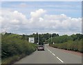
1
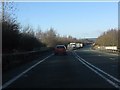
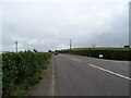
A5 about to cross the B4473
A common scene on this part of the A5: traffic queued behind a slow moving vehicle, in this instance a lorry which is only allowed to proceed at 40mph on this type of road. Traffic in the other direction benefits from an extra lane on the uphill grade.
Image: © Peter Whatley
Taken: 18 Jan 2011
0.10 miles
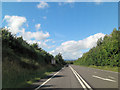
2
A5 with the parapet of the bridge over B4473
The A5 Shrewsbury bypass runs on an embankment and bridge over the River Severn. It crosses the B4473 south of Montford Bridge over the river
Image: © David Smith
Taken: 23 Apr 2015
0.11 miles
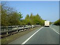
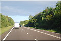
4
A5 passes over B4473
This is the new A5, of course. The old A5 can be reached by passing under the bridge and driving another half-mile.
Image: © Mike White
Taken: 28 Sep 2008
0.13 miles
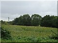
7
B4380 approaching road junction near Grange Farm
Image: © John Firth
Taken: 26 Jul 2013
0.16 miles
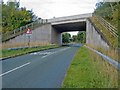
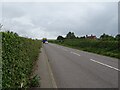
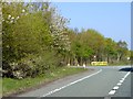
9
Holyhead Road (B4380) near Grange Farm
Towards Shrewsbury.
Image: © JThomas
Taken: 4 Sep 2024
0.18 miles
10
Entrance to Montford picnic site from A5 northbound
The picnic site fills a gap between the A5 and River Severn. The trees screen the site from the road noise, but conceal the cafe from passing traffic, so the sign is there for publicity
Image: © David Smith
Taken: 23 Apr 2015
0.22 miles