IMAGES TAKEN NEAR TO
Lythwood Road, SHREWSBURY, SY3 0NT
Introduction
This page details the photographs taken nearby to Lythwood Road, SY3 0NT by members of the Geograph project.
The Geograph project started in 2005 with the aim of publishing, organising and preserving representative images for every square kilometre of Great Britain, Ireland and the Isle of Man.

There are currently over 7.5m images from over14,400 individuals and you can help contribute to the project by visiting https://www.geograph.org.uk
Image Map
Images are licensed for reuse under creativecommons.org/licenses/by-sa/2.0
Notes
- Clicking on the map will re-center to the selected point.
- The higher the marker number, the further away the image location is from the centre of the postcode.
Image Listing (14 Images Found)
Images are licensed for reuse under creativecommons.org/licenses/by-sa/2.0
Image
Details
Distance
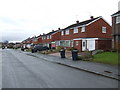
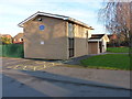
2
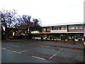
Shops and flats in Bayston Hill
One of those old 1960's blocks. Lovely.
Image: © Jeremy Bolwell
Taken: 10 Nov 2016
0.08 miles
3
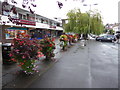
Floral displays outside the row of shops
Great to see this brilliant display here.
Image: © Jeremy Bolwell
Taken: 9 Aug 2017
0.09 miles
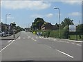
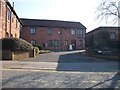
4
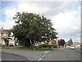
Crossroads in Bayston Hill
Looking down Lythwood Road, from the crossing with Glebe Road (to the right) and Ovrdale Road (on the left)
Image: © Richard Law
Taken: 28 Jan 2012
0.09 miles
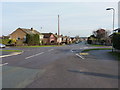
5
Glebe Road, Bayston Hill
Junction with Yew Tree drive. Taken when lost, looking for Lyth Hill. (GR recorded on GPS at the time - it knew where I was)
Image: © Richard Webb
Taken: 30 Jul 2009
0.14 miles
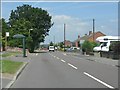
8
Glebe Road, Bayston Hill
A dormitary village to the south of Shrewsbury.
Image: © Jonathan Billinger
Taken: 6 Dec 2007
0.17 miles
9
Bayston Hill Methodist Church
A reasonably modern church on Landsdowne Road, Bayston Hill.
Image: © Richard Law
Taken: 28 Jan 2012
0.18 miles
10
Trig point surrounded with buildings
The number of this Trig point is showing OSBM S1912 http://www.bench-marks.org.uk/bm3836 and flush bracket on the building is OSBM 2880 http://www.bench-marks.org.uk/bm2289 , it's almost as if this trig point doesn't belong here
Image: © Mr M Evison
Taken: 7 Mar 2010
0.20 miles