IMAGES TAKEN NEAR TO
Severn Street, CAERSWS, SY17 5DZ

Introduction

This page details the photographs taken nearby to Severn Street, SY17 5DZ by members of the Geograph project.

The Geograph project started in 2005 with the aim of publishing, organising and preserving representative images for every square kilometre of Great Britain, Ireland and the Isle of Man.

There are currently over 7.5m images from over14,400 individuals and you can help contribute to the project by visiting https://www.geograph.org.uk

Image Map


Images are licensed for reuse under creativecommons.org/licenses/by-sa/2.0
Notes
  • Clicking on the map will re-center to the selected point.
  • The higher the marker number, the further away the image location is from the centre of the postcode.

Image Listing (185 Images Found)

Images are licensed for reuse under creativecommons.org/licenses/by-sa/2.0
  • ...
Image
Details
Distance
1
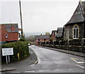
Severn Street, Caersws
Looking towards Bridge Street from the corner of Chapel Street. Severn Street is on the north bank of the River Severn.
Image: © Jaggery Taken: 4 Nov 2015
0.01 miles
2
Empty playground
Next to the Presbyterian Church in Caersws
Image: © Eirian Evans Taken: 1 Jul 2009
0.02 miles
3
Chapel Street houses, Caersws
Chapel Street is between Main Street and Severn Street.
Image: © Jaggery Taken: 4 Nov 2015
0.03 miles
4
Children's playground, Caersws
On the SE side of Main Street. A nearby plaque http://www.geograph.org.uk/photo/4728769 records that the playground was provided with the help of a grant from the National Playing Fields Association.
Image: © Jaggery Taken: 4 Nov 2015
0.04 miles
5
New Street, Caersws
Dead-end street extending for 65 metres from Bridge Street. The village post office used to be in the corner premises on the right, as seen in this http://www.geograph.org.uk/photo/2871282 late March 2012 view.
Image: © Jaggery Taken: 4 Nov 2015
0.04 miles
6
Chapel Street, Caersws
The bilingual (Welsh and English) sign on the corner of Main Street shows that Chapel Street leads to Severn Street. Caersws Presbyterian Church http://www.geograph.org.uk/photo/4728753 is on the right.
Image: © Jaggery Taken: 4 Nov 2015
0.04 miles
7
Caersws Baptist Church
Viewed across Chapel Street.
Image: © Jaggery Taken: 4 Nov 2015
0.04 miles
8
Caersws Baptist Church and churchyard
Viewed across Chapel Street. Part of the churchyard is on the left.
Image: © Jaggery Taken: 4 Nov 2015
0.04 miles
9
West side of Caersws Presbyterian Church
Viewed from Main Street across a children's playground. http://www.geograph.org.uk/photo/4728753 to another view of the church.
Image: © Jaggery Taken: 4 Nov 2015
0.04 miles
10
Western end of Severn Street, Caersws
On the north bank of the River Severn, viewed across Bridge Street. Severn Street leads to Chapel Street.
Image: © Jaggery Taken: 4 Nov 2015
0.05 miles
  • ...