IMAGES TAKEN NEAR TO
Campion Close, NEWTOWN, SY16 2TD

Introduction

This page details the photographs taken nearby to Campion Close, SY16 2TD by members of the Geograph project.

The Geograph project started in 2005 with the aim of publishing, organising and preserving representative images for every square kilometre of Great Britain, Ireland and the Isle of Man.

There are currently over 7.5m images from over14,400 individuals and you can help contribute to the project by visiting https://www.geograph.org.uk

Image Map


Images are licensed for reuse under creativecommons.org/licenses/by-sa/2.0
Notes
  • Clicking on the map will re-center to the selected point.
  • The higher the marker number, the further away the image location is from the centre of the postcode.

Image Listing (45 Images Found)

Images are licensed for reuse under creativecommons.org/licenses/by-sa/2.0
  • ...
Image
Details
Distance
1
Weeping ash tree at Llanllwchaearn
A closer view to show its curving trunk. See also http://www.geograph.org.uk/photo/3549614
Image: © Penny Mayes Taken: 4 Jul 2013
0.05 miles
2
Weeping ash tree at Llanllwchaearn
Near the churchyard gate is this wonderful weeping ash. For a closer view see http://www.geograph.org.uk/photo/3549617
Image: © Penny Mayes Taken: 4 Jul 2013
0.05 miles
3
New development in Llanllwchaiarn
Seen from the churchyard.
Image: © Penny Mayes Taken: 17 Oct 2007
0.05 miles
4
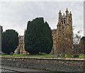
Llanllwchaiarn Church
Image: © PAUL FARMER Taken: 8 Oct 2020
0.05 miles
5
Ordnance Survey Cut Mark
This OS cut mark can be found on the NW face of St Llwchaiarn's Church. It marks a point 107.1208m above mean sea level.
Image: © Adrian Dust Taken: 29 Jan 2017
0.06 miles
6
Benchmark on Llanllwchaiarn Parish Church
On the north wall of the church towards the eastern end. Details of this cut mark may be found on the Bench Mark database here http://www.bench-marks.org.uk/bm33905 . For a closer view see http://www.geograph.org.uk/photo/3033771 There is another cut mark with bolt on the tower - see http://www.geograph.org.uk/photo/1848887
Image: © Penny Mayes Taken: 25 Jun 2012
0.06 miles
7
Benchmark on Llanllwchaiarn Parish Church
On the north wall of the church towards the eastern end. Details of this cut mark may be found on the Bench Mark database here http://www.bench-marks.org.uk/bm33905 . There is another cut mark on the tower - see http://www.geograph.org.uk/photo/1848887.
Image: © Penny Mayes Taken: 25 Jun 2012
0.06 miles
8
Ordnance Survey 1GL Bolt
This OS Bolt can be found on the SW face of St Llwchaiarn's Church. It marks a point 107.248m above mean sea level.
Image: © Adrian Dust Taken: 29 Jan 2017
0.06 miles
9
Llanllwchaiarn Parish Church - west door
The door at the foot of the tower. Note the date stone showing 1813 and the cut benchmark and bolt http://www.geograph.org.uk/photo/1848887 to the left of the door.
Image: © Penny Mayes Taken: 12 Apr 2010
0.06 miles
10
Benchmark on Llanllwchaiarn Parish Church
Beside the door at the foot of the tower. A 1GL bolt mark which was levelled on the Worcester to Aberystwyth line during 1849-1855 survey. Details on the bench mark database http://www.bench-marks.org.uk/bm33906 For a wider view see Image There is another cut mark on the NE corner of this church - see http://www.geograph.org.uk/photo/3033771
Image: © Penny Mayes Taken: 12 Apr 2010
0.06 miles
  • ...