Benchmark on Llanllwchaiarn Parish Church
Introduction
The photograph on this page of Benchmark on Llanllwchaiarn Parish Church by Penny Mayes as part of the Geograph project.
The Geograph project started in 2005 with the aim of publishing, organising and preserving representative images for every square kilometre of Great Britain, Ireland and the Isle of Man.

There are currently over 7.5m images from over 14,400 individuals and you can help contribute to the project by visiting https://www.geograph.org.uk
Benchmark on Llanllwchaiarn Parish Church
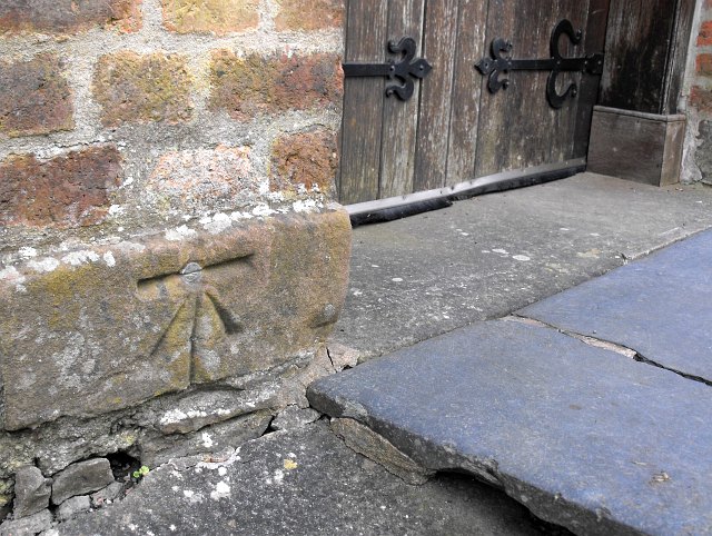
Image: © Penny Mayes Taken: 12 Apr 2010
Beside the door at the foot of the tower. A 1GL bolt mark which was levelled on the Worcester to Aberystwyth line during 1849-1855 survey. Details on the bench mark database http://www.bench-marks.org.uk/bm33906 For a wider view see Image There is another cut mark on the NE corner of this church - see http://www.geograph.org.uk/photo/3033771
Images are licensed for reuse under creativecommons.org/licenses/by-sa/2.0
Image Location
Latitude
52.523481
Longitude
-3.293152