IMAGES TAKEN NEAR TO
Cae Cymric, NEWTOWN, SY16 2JU

Introduction

This page details the photographs taken nearby to Cae Cymric, SY16 2JU by members of the Geograph project.

The Geograph project started in 2005 with the aim of publishing, organising and preserving representative images for every square kilometre of Great Britain, Ireland and the Isle of Man.

There are currently over 7.5m images from over14,400 individuals and you can help contribute to the project by visiting https://www.geograph.org.uk

Image Map


Images are licensed for reuse under creativecommons.org/licenses/by-sa/2.0
Notes
  • Clicking on the map will re-center to the selected point.
  • The higher the marker number, the further away the image location is from the centre of the postcode.

Image Listing (242 Images Found)

Images are licensed for reuse under creativecommons.org/licenses/by-sa/2.0
  • ...
Image
Details
Distance
1
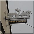
The Waggon and Horses Canal Road, Newtown
The Waggon and Horses sign after snow.
Image: © Henry Spooner Taken: 18 Jan 2013
0.03 miles
2
Dinam Terrace Canal Road Newtown
Terraced housing set back off the Canal Road.
Image: © Henry Spooner Taken: 13 May 2009
0.03 miles
3
Canal Road
Looking West from the junction of Lower Canal Road and Canal Road.
Image: © Henry Spooner Taken: 6 Mar 2011
0.04 miles
4
Terrace of cottages beside the Waggon & Horses pub
A row of 5 former canal wharf workers' cottages, according to the description in the Historic Wales/Coflein website https://coflein.gov.uk/en/site/407381/, although if that's the case then 2 have no windows. It's possible that the 'missing' pair are the white building on the right, which are actually now part of the adjacent pub Image There were several wharves on the former Shropshire Union Canal branch which ran into this part of Newtown, mostly serving the burgeoning flannel and weaving businesses of the town in the 18th & 19th centuries.
Image: © Richard Law Taken: 9 Jul 2022
0.04 miles
5
The Waggon & Horses public house, Newtown
Described in the Historic Wales/Coflein detail as 'built sometime between 1833 and 1842' the pub backs onto a row of former canal workers' cottage, some of which look as if they have been converted to part of the pub.
Image: © Richard Law Taken: 9 Jul 2022
0.04 miles
6
Cae Cymric, Canal Road, Newtown.
Housing off Canal Road, Newtown.
Image: © Henry Spooner Taken: 4 May 2009
0.04 miles
7
Afon Way
Viewed from Lower Canal Road. Afon Way is a social housing development subject to a local needs occupancy restriction and consists of apartments and terraced houses.
Image: © Penny Mayes Taken: 29 Oct 2018
0.05 miles
8
Waggon & Horses
Image: © Alex McGregor Taken: 17 Dec 2013
0.05 miles
9
Christmas morning in Mwyn Fynydd, Newtown
Only an inch or two of snow has fallen here in the last week but it still lingers on the ground. The tower of the redundant church of St David http://www.geograph.org.uk/photo/1424901 can be seen on the left with the Kerry Hills rising behind it. Yr Allt Gethin in the distance.
Image: © Penny Mayes Taken: 25 Dec 2009
0.05 miles
10
View across the Severn valley
On a sunny New Year's Day. All the built-up area visible in this view is within this grid square.
Image: © Penny Mayes Taken: 1 Jan 2022
0.05 miles
  • ...