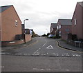
1
Ordnance Survey Cut Mark
This OS cut mark can be found on No157 New Park Road . It marks a point 52.791m above mean sea level.
Image: © Adrian Dust
Taken: 3 Jul 2023
0.04 miles
2
John Street Church, Castlefields, Shrewsbury
On the corner of John Street and Newpark Road. The Shropshire History website states that this is a small non-denominational Gospel Hall built in the early 1880s. During the 1890s it developed into an Assembly of Open Brethren, who still use the building.
Image: © Jaggery
Taken: 17 Oct 2016
0.07 miles
3
John Street, Castlefields, Shrewsbury
Viewed from Newpark Road looking along John Street towards Castlefields Allotments.
John Street Church http://www.geograph.org.uk/photo/5159143 is on the left.
Image: © Jaggery
Taken: 17 Oct 2016
0.07 miles
4
1-8 Pretoria Terrace, John Street, Castlefields, Shrewsbury
Apparently built by LMS railway for their Shrewsbury based train drivers in the late Victorian era. The houses have stone flagged back yards rather than gardens, and also an alley, fully cobbled, running around them to give rear access and vehicular access, quite rare in this suburb.
Image: © Jeremy Bolwell
Taken: 10 Jun 2020
0.07 miles
5
Cobbled alleyway on John Street, Castlefields, Shrewsbury
Providing rear access to the terrace on the right, named Pretoria Terrace, and apparently built by LMS railway for their Shrewsbury based train drivers in the 1890s.
Image: © Jeremy Bolwell
Taken: 10 Jun 2020
0.09 miles
6
Allottment gardens in Castlefields, Shrewsbury
Active allotment plots well tended here.
Image: © Jeremy Bolwell
Taken: 10 Jun 2020
0.09 miles
7
Information board in Castlefields
Another board on the Shrewsbury Canal.
Image: © Jeremy Bolwell
Taken: 6 Sep 2020
0.11 miles
8
Greenway between Shrewsbury town centre and Ditherington
Part of a 25 mile 'greenway' largely following the route of the former Shrewsbury canal.
Image: © Stephen Craven
Taken: 16 Oct 2022
0.11 miles
9
Recreation ground in the Spring Gardens area of Shrewsbury
Actually being used too.
Image: © Jeremy Bolwell
Taken: 3 Jan 2021
0.12 miles
10
Beddow Close, Castlefields, Shrewsbury
Cul-de-sac viewed across the St Michael's Street, opposite the Dolphin Inn. http://www.geograph.org.uk/photo/4742809
Image: © Jaggery
Taken: 16 Nov 2015
0.12 miles


