IMAGES TAKEN NEAR TO
Treflach, OSWESTRY, SY10 9HU
Introduction
This page details the photographs taken nearby to SY10 9HU by members of the Geograph project.
The Geograph project started in 2005 with the aim of publishing, organising and preserving representative images for every square kilometre of Great Britain, Ireland and the Isle of Man.

There are currently over 7.5m images from over14,400 individuals and you can help contribute to the project by visiting https://www.geograph.org.uk
Image Map
Images are licensed for reuse under creativecommons.org/licenses/by-sa/2.0
Notes
- Clicking on the map will re-center to the selected point.
- The higher the marker number, the further away the image location is from the centre of the postcode.
Image Listing (10 Images Found)
Images are licensed for reuse under creativecommons.org/licenses/by-sa/2.0
Image
Details
Distance
1
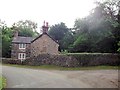
House on bend of Wern y Wiel
Lane to right leads to Dawn House
Image: © John Firth
Taken: 4 Jul 2013
0.04 miles
3
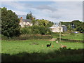
Llamas in field by Whitehaven
Each animal has a different colour wool.
Image: © John Haynes
Taken: 14 Sep 2007
0.06 miles
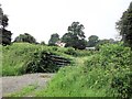
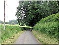
4
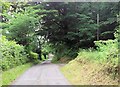
Track near Treflach
A quiet sheltered little lane, ideal walking on a Spring morning.
Image: © Jeremy Bolwell
Taken: 28 Mar 2011
0.14 miles
5
Entrance to Middle Forest from Wern y Wiel
Image: © John Firth
Taken: 4 Jul 2013
0.16 miles
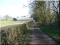
7
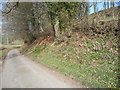
Spring flowers in the lane
The warm March sunshine is bringing the verges and hedgerows to life at last.
Image: © Jeremy Bolwell
Taken: 28 Mar 2011
0.17 miles
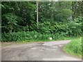
8
Wern y Wiel at entrance to Pleasant Grove
Footpath starts here as shown by sign on right
Image: © John Firth
Taken: 4 Jul 2013
0.20 miles
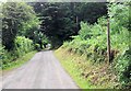
9
Lane through small wooded area south of Treflach Farm
Image: © John Firth
Taken: 4 Jul 2013
0.22 miles
10
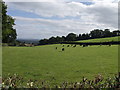
Cattle grazing
Great view from up here, looking out towards Morton.
Image: © John Haynes
Taken: 14 Sep 2007
0.23 miles