IMAGES TAKEN NEAR TO
Maesyllan, OSWESTRY, SY10 7QE

Introduction

This page details the photographs taken nearby to Maesyllan, SY10 7QE by members of the Geograph project.

The Geograph project started in 2005 with the aim of publishing, organising and preserving representative images for every square kilometre of Great Britain, Ireland and the Isle of Man.

There are currently over 7.5m images from over14,400 individuals and you can help contribute to the project by visiting https://www.geograph.org.uk

Image Map


Images are licensed for reuse under creativecommons.org/licenses/by-sa/2.0
Notes
  • Clicking on the map will re-center to the selected point.
  • The higher the marker number, the further away the image location is from the centre of the postcode.

Image Listing (158 Images Found)

Images are licensed for reuse under creativecommons.org/licenses/by-sa/2.0
  • ...
Image
Details
Distance
1
Maes y Llan
a crescent of semi-detached houses in post-war "council house" style. These are large, comfortable, houses. The former grassed area in front of them has been partially paved as a car park, because (of course) no provision for private cars would have been thought necessary when they were built.
Image: © Bob Harvey Taken: 9 Oct 2019
0.02 miles
2
Massey Ferguson 5713SL
A modern tractor, parked up at Image
Image: © Bob Harvey Taken: 9 Oct 2019
0.03 miles
3
Recycling location
Part of the car park at Image is reserved for recycling containers. A stern notice about their use is nearby
Image: © Bob Harvey Taken: 9 Oct 2019
0.03 miles
4
Crab apples
Part of the planting that screens Image from the main road, and the weather
Image: © Bob Harvey Taken: 9 Oct 2019
0.04 miles
5
Bus shelter
The bus shelter at Image stands with its back to the road, presumably because the prevailing, (and often rainy) winds come from that direction. The road is the B4508 through Llansilin The former chapel of Image can be glimpsed through the shelter.
Image: © Bob Harvey Taken: 9 Oct 2019
0.04 miles
6
Tourist information
Visible behind the bus shelter in Image is this tourist information board (seen here from the other side) which majors on the Owain Glyndower connection with Llansilin.
Image: © Bob Harvey Taken: 9 Oct 2019
0.04 miles
7
Bilingual information
The text of Image is reproduced in both languages.
Image: © Bob Harvey Taken: 9 Oct 2019
0.04 miles
8
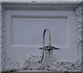
Bethesda
Former chapel, originally built in 1815, rebuilt in 1832 and again in 1871. Served the "Welsh Independent" style of congregational worship until the last service was held on the 21st of October, 2010 (see http://www.llansilin.org/newsletter/NL72.pdf ). The building is now a private house. The building is recorded at https://www.coflein.gov.uk/en/site/7809/details/bethesda-welsh-independent-chapel-llansilin
Image: © Bob Harvey Taken: 9 Oct 2019
0.05 miles
9
Datestone
On the front of Image is this dedication stone dating from the first reconstruction in 1832 "Bethesda Addoldu yr annibynwyr Adeiladwyd 1832" 1832 was the year of the Great Reform Act, a cholera epidemic in London, the foundation of Durham University and the building of Cardiff prison. In a great storm 105 men, in 31 open fishing boats, were drowned in Shetland. Ecuador annexed the Galápagos Islands; the Beagle (carrying Charles Darwin) arrived in South America; and the first ever Baedecker guide book was published.
Image: © Bob Harvey Taken: 9 Oct 2019
0.05 miles
10
Former Bethesda Chapel
Built 1832 by the Welsh Independents. Sensitively restored as private housing.
Image: © John H Darch Taken: 2 Feb 2022
0.05 miles
  • ...