Bilingual information
Introduction
The photograph on this page of Bilingual information by Bob Harvey as part of the Geograph project.
The Geograph project started in 2005 with the aim of publishing, organising and preserving representative images for every square kilometre of Great Britain, Ireland and the Isle of Man.

There are currently over 7.5m images from over 14,400 individuals and you can help contribute to the project by visiting https://www.geograph.org.uk
Bilingual information
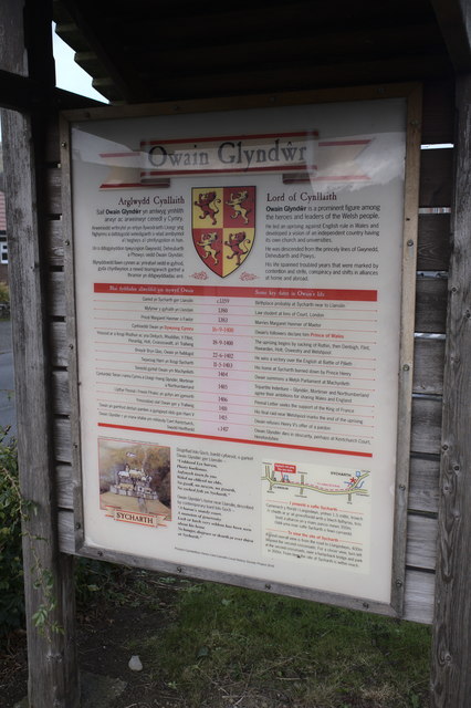
Image: © Bob Harvey Taken: 9 Oct 2019
The text of Image is reproduced in both languages.
Images are licensed for reuse under creativecommons.org/licenses/by-sa/2.0
Image Location
Latitude
52.843415
Longitude
-3.17495