IMAGES TAKEN NEAR TO
Llangynog, OSWESTRY, SY10 0HB
Introduction
This page details the photographs taken nearby to SY10 0HB by members of the Geograph project.
The Geograph project started in 2005 with the aim of publishing, organising and preserving representative images for every square kilometre of Great Britain, Ireland and the Isle of Man.

There are currently over 7.5m images from over14,400 individuals and you can help contribute to the project by visiting https://www.geograph.org.uk
Image Map
Images are licensed for reuse under creativecommons.org/licenses/by-sa/2.0
Notes
- Clicking on the map will re-center to the selected point.
- The higher the marker number, the further away the image location is from the centre of the postcode.
Image Listing (14 Images Found)
Images are licensed for reuse under creativecommons.org/licenses/by-sa/2.0
Image
Details
Distance
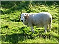
1

Little used footpath
At the end of the first field the path disappears into a bracken forest.
Image: © Row17
Taken: 4 Sep 2011
0.09 miles
3
Below Craig Rhiwarth
An axle from an incline drum in the foreground.
Image: © Chris Andrews
Taken: 23 Sep 2022
0.14 miles
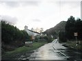
4
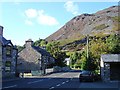
The road to Bala
B4391 leaving Llangynog
Image: © John Firth
Taken: 19 Jan 2011
0.15 miles
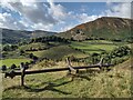
5
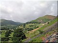
Llangynog with Y Gribin
Taken from the bridle path on Craig Rhiwarth
Image: © David White
Taken: 27 Jun 2004
0.18 miles
6
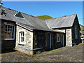
Former village school in Llangynog
Now converted (in 1987) to the Village Workshops.
Image: © Richard Law
Taken: 15 May 2019
0.20 miles
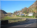
7
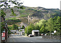
Craig Rhiwarth
From Llangynog which lies at the confluence of the Tanat and Eirth with three steep mountains surrounding it. Slate and granite were quarried and lead was mined here. There are still working quarries in the area.
Image: © Penny Mayes
Taken: 4 Sep 2007
0.21 miles
8
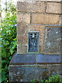
OS Flush Bracket - Llangynog, former school
Flush Bracket S0824, affixed to the wall of the former school in Llangynog. It was levelled on the Llanderfel to Oswestry line survey line, probably in the late 1950s as part of the 3rd Geodetic Levelling of England and Wales, at 546ft 1in
Image: © Richard Law
Taken: 15 May 2019
0.22 miles
9
Craig Rhiwarth from Berwyn Street, Llangynog
Craig Rhiwarth with disused slate quarry incline
Image: © John Robertson
Taken: 13 Jul 2005
0.23 miles