OS Flush Bracket - Llangynog, former school
Introduction
The photograph on this page of OS Flush Bracket - Llangynog, former school by Richard Law as part of the Geograph project.
The Geograph project started in 2005 with the aim of publishing, organising and preserving representative images for every square kilometre of Great Britain, Ireland and the Isle of Man.

There are currently over 7.5m images from over 14,400 individuals and you can help contribute to the project by visiting https://www.geograph.org.uk
OS Flush Bracket - Llangynog, former school
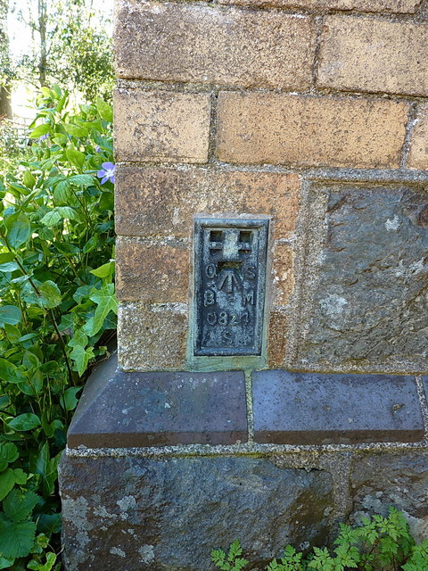
Image: © Richard Law Taken: 15 May 2019
Flush Bracket S0824, affixed to the wall of the former school in Llangynog. It was levelled on the Llanderfel to Oswestry line survey line, probably in the late 1950s as part of the 3rd Geodetic Levelling of England and Wales, at 546ft 1in
Images are licensed for reuse under creativecommons.org/licenses/by-sa/2.0
Image Location
Latitude
52.82432
Longitude
-3.407947