
IMAGES TAKEN NEAR TO
Somerleyton Road, LONDON, SW9 8TZ
Introduction
This page details the photographs taken nearby to Somerleyton Road, SW9 8TZ by members of the Geograph project.
The Geograph project started in 2005 with the aim of publishing, organising and preserving representative images for every square kilometre of Great Britain, Ireland and the Isle of Man.

There are currently over 7.5m images from over14,400 individuals and you can help contribute to the project by visiting https://www.geograph.org.uk
Image Map
Images are licensed for reuse under creativecommons.org/licenses/by-sa/2.0
Notes
- Clicking on the map will re-center to the selected point.
- The higher the marker number, the further away the image location is from the centre of the postcode.
Image Listing (227 Images Found)
Images are licensed for reuse under creativecommons.org/licenses/by-sa/2.0
Image
Details
Distance
1
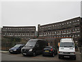
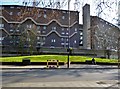
Southwyck House, Brixton (1)
Southwyck House, also known locally as the "barrier block", consists of five linked high-rise blocks built c.1980 and forming a long row on the south side of Coldharbour Lane. The name may reflect the former name of the area, “Lambeth Wick”. This photos only shows part of it. See also Image for a view from the other side.
For a more detailed history and description, see http://www.urban75.org/brixton/features/barrier.html
Image: © Stephen Craven
Taken: 19 Mar 2015
0.03 miles
2
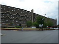
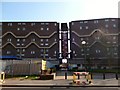
Southwyck House, Brixton
This block of flats is on Coldharbour Lane SW9, very near Brixton town centre. It is known locally as the Barrier Block and it has had an interesting history. Click here http://www.urban75.org/brixton/features/barrier.html for an excellent website that tells more. The reason why the block was built to look like that was to deflect traffic noise from a proposed multi lane highway that was never built.
Image: © Danny P Robinson
Taken: 17 Aug 2006
0.06 miles
3
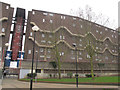
Southwyck House, Brixton (1)
Southwyck House, also known locally as the "barrier block", consists of five linked high-rise blocks built c.1980 and forming a long row on the south side of Coldharbour Lane. The name may reflect the former name of the area, “Lambeth Wick”. This photos only shows part of it. See also Image for a view from the other side.
For a more detailed history and description, see http://www.urban75.org/brixton/features/barrier.html
Image: © Stephen Craven
Taken: 19 Mar 2015
0.06 miles
4
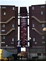
Stairwell, Southwyck House, Coldharbour Lane SW9
Image: © Robin Sones
Taken: 5 Mar 2013
0.07 miles
6
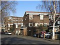
Entrance. Southwyck House, Coldharbour Lane SW9
Image: © Robin Sones
Taken: 5 Mar 2013
0.07 miles
8
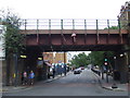
Bridge over Coldharbour Lane, Brixton
A railway bridge over Coldharbour Lane in Brixton. The warning sign on the bridge indicates that vehicles more than 14'3" high should not attempt to go under the bridge.
Image: © Malc McDonald
Taken: 30 May 2011
0.08 miles
10
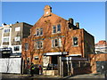
The (former) Walton Lodge Sanitary Steam Laundry, Coldharbour Lane, SW9
The laundry closed as recently as 2014, after trading for nearly 120 years http://www.brixtonbuzz.com/2014/06/walton-lodge-laundry-in-brixton-closes-after-nearly-120-years-of-service/ .
Image: © Mike Quinn
Taken: 17 Jan 2018
0.08 miles