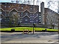
IMAGES TAKEN NEAR TO
Arches, Brixton Station Road, LONDON, SW9 8PF
Introduction
This page details the photographs taken nearby to Arches, Brixton Station Road, SW9 8PF by members of the Geograph project.
The Geograph project started in 2005 with the aim of publishing, organising and preserving representative images for every square kilometre of Great Britain, Ireland and the Isle of Man.

There are currently over 7.5m images from over14,400 individuals and you can help contribute to the project by visiting https://www.geograph.org.uk
Image Map
Images are licensed for reuse under creativecommons.org/licenses/by-sa/2.0
Notes
- Clicking on the map will re-center to the selected point.
- The higher the marker number, the further away the image location is from the centre of the postcode.
Image Listing (216 Images Found)
Images are licensed for reuse under creativecommons.org/licenses/by-sa/2.0
Image
Details
Distance
1
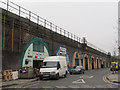
Brixton Station Road
The road runs parallel and adjacent to the railway viaduct. The two arches nearest the camera are occupied by a wholesale greengrocer, and the six beyond that by the Brixton Brewery.
Image: © Stephen Craven
Taken: 19 Mar 2015
0.01 miles
2
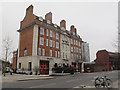
Gresham Road fire station, Brixton
The fire station opened in 1906 on the site of the former church of St Catherine, Loughborough Park (opened 1877, date of closure unknown). Now grade 2 listed (list entry number 1251337) http://list.historicengland.org.uk/resultsingle.aspx?uid=1251337
Image: © Stephen Craven
Taken: 19 Mar 2015
0.01 miles
3
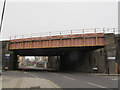
Gresham Road railway bridges, Brixton
See Image for a view from the other side with a brief history.
Image: © Stephen Craven
Taken: 19 Mar 2015
0.03 miles
4
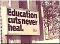
Education cuts never heal
'Education cuts never heal,' an ILEA (Inner London Education Authority) poster from the early 1980's. This image is taken from a scanned photograph.
Image: © Dave Pickersgill
Taken: 1 Jun 1984
0.05 miles
5
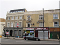
Former Angel pub, Coldharbour Lane, Brixton
The pub apparently closed in 2011, the ground floor briefly becoming a Tesco express that itself had closed by the time this photo was taken in 2015, and the upper floors redeveloped for housing. Next to it are an internet cafe and fish bar.
For a more detailed history and other photos, see http://www.urban75.org/brixton/bars/the-angel-coldharbour-lane-brixton.html
Image: © Stephen Craven
Taken: 19 Mar 2015
0.05 miles
7
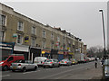
Shops on Coldharbour Lane, Brixton
Despite this being around midday on a weekday, many of the shop units were closed.
Image: © Stephen Craven
Taken: 19 Mar 2015
0.06 miles
8
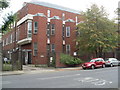
Brixton Telephone Exchange
Located at 45 Gresham Road, this TE used to have BRIxton and REDpost numbers until the late 1960s. Besides Brixton, this TE also serves Herne Hill nearby, and now has 0207-274, 733, 737 and 926 numbers. Looking at the brickwork and windows, this TE would appear to have been rebuilt quite recently. Its postcode is SW9 7NU.
Image: © David Hillas
Taken: 4 Oct 2011
0.06 miles
9
Stairwell, Southwyck House, Coldharbour Lane SW9
Image: © Robin Sones
Taken: 5 Mar 2013
0.07 miles