
IMAGES TAKEN NEAR TO
Rupert Gardens, LONDON, SW9 7TN
Introduction
This page details the photographs taken nearby to Rupert Gardens, SW9 7TN by members of the Geograph project.
The Geograph project started in 2005 with the aim of publishing, organising and preserving representative images for every square kilometre of Great Britain, Ireland and the Isle of Man.

There are currently over 7.5m images from over14,400 individuals and you can help contribute to the project by visiting https://www.geograph.org.uk
Image Map
Images are licensed for reuse under creativecommons.org/licenses/by-sa/2.0
Notes
- Clicking on the map will re-center to the selected point.
- The higher the marker number, the further away the image location is from the centre of the postcode.
Image Listing (58 Images Found)
Images are licensed for reuse under creativecommons.org/licenses/by-sa/2.0
Image
Details
Distance
1
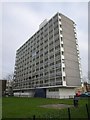
Secker House, Brixton
The northeasternmost of four similar 11-storey blocks, seen from Minet Road.
Image: © Derek Harper
Taken: 11 Mar 2011
0.05 miles
2
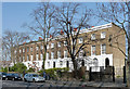
99-113 Loughborough Road
A happy survival, albeit almost entirely enveloped by the Loughborough Estate. An early C19th terrace in stock brick with stuccoed ground floor. Grade II listed.
Image: © Stephen Richards
Taken: 24 Mar 2012
0.07 miles
3
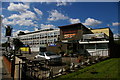
The "Hero of Switzerland" pub, Loughborough Road
There has been a "Hero of Switzerland" pub on this site since at least 1901 (see relevant issue of Kelly's "Post Office London"), although this building clearly dates from the same post-war period as the flats around it.
Image: © Christopher Hilton
Taken: 1 Jul 2011
0.09 miles
4
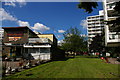
The "Hero of Switzerland" pub and the Loughborough Estate, Loughborough Road
There has been a "Hero of Switzerland" pub on this site since at least 1901 (see relevant issue of Kelly's "Post Office London"), although this building clearly dates from the same post-war period as the flats around it.
Image: © Christopher Hilton
Taken: 1 Jul 2011
0.09 miles
5
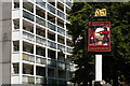
The "Hero of Switzerland" pub and Loughborough Estate flats, Loughborough Road
There has been a "Hero of Switzerland" pub on this site since at least 1901 (see relevant issue of Kelly's "Post Office London"), although this building clearly dates from the same post-war period as the flats around it.
Image: © Christopher Hilton
Taken: 1 Jul 2011
0.09 miles
6
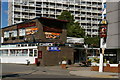
The "Hero of Switzerland" pub, Loughborough Road
There has been a "Hero of Switzerland" pub on this site since at least 1901 (see relevant issue of Kelly's "Post Office London"), although this building clearly dates from the same post-war period as the flats around it.
Image: © Christopher Hilton
Taken: 1 Jul 2011
0.09 miles
7
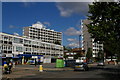
The Loughborough Estate, looking north-west along Loughborough Road
In the distance, the Hero of Switzerland pub (Image). There has been a "Hero of Switzerland" pub on this site since at least 1901 (see relevant issue of Kelly's "Post Office London"), although this building clearly dates from the same post-war period as the flats around it.
Image: © Christopher Hilton
Taken: 1 Jul 2011
0.09 miles
8
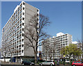
Loughborough Estate, Loughborough Road (1)
The estate was built in 1953-57 to the designs of the London County Council's chief architect Leslie Martin. Here are three of the four eleven-storey blocks, bearing the influence of Le Corbusier's Unite d'Habitation in Marseilles.
Image: © Stephen Richards
Taken: 24 Mar 2012
0.10 miles
9

Elam Street Open Space
An important green space off Gordon Grove and beside the raised railway (right, with arches) north of Loughborough Junction.
Image: © Derek Harper
Taken: 11 Mar 2011
0.11 miles
10
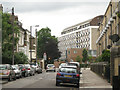
Iveagh House, Loughborough Road, from Akerman Road
Image: © Robin Stott
Taken: 23 Jun 2013
0.13 miles