
IMAGES TAKEN NEAR TO
Canterbury Crescent, LONDON, SW9 7QF
Introduction
This page details the photographs taken nearby to Canterbury Crescent, SW9 7QF by members of the Geograph project.
The Geograph project started in 2005 with the aim of publishing, organising and preserving representative images for every square kilometre of Great Britain, Ireland and the Isle of Man.

There are currently over 7.5m images from over14,400 individuals and you can help contribute to the project by visiting https://www.geograph.org.uk
Image Map
Images are licensed for reuse under creativecommons.org/licenses/by-sa/2.0
Notes
- Clicking on the map will re-center to the selected point.
- The higher the marker number, the further away the image location is from the centre of the postcode.
Image Listing (283 Images Found)
Images are licensed for reuse under creativecommons.org/licenses/by-sa/2.0
Image
Details
Distance
1
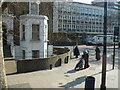
Brixton Police Station
The police station is the modern building in the background. The older house in the foreground is on the Brixton Rd. Full length Hijab Muslim clothing such as this is often seen in this area.
Image: © Nigel Mykura
Taken: 5 Mar 2013
0.01 miles
2
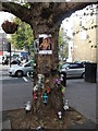
Tree Memorial, Brixton
Memorial to a fallen teenager on Gresham Road, outside Brixton Police Station.
See http://www.ligali.org/forums/index.php?app=calendar&module=calendar§ion=view&do=showevent&event_id=10 for more details.
Image: © David Anstiss
Taken: 20 Nov 2011
0.02 miles
5
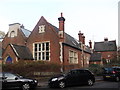
Former St John's Church of England school, Brixton
Former school on Canterbury Crescent. Grade II listed.
See http://www.britishlistedbuildings.co.uk/en-204094-former-st-john-s-church-of-england-schoo fore more details.
Image: © David Anstiss
Taken: 20 Nov 2011
0.03 miles
6
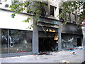
Foot Locker, Brixton Road SW9
Post riot, looting and burning
Image: © Robin Sones
Taken: 8 Aug 2011
0.04 miles
7
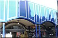
Budget Carpets, Brixton Station Road SW9
Image: © Robin Sones
Taken: 7 Apr 2009
0.04 miles
8
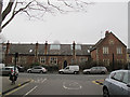
St Johns Building, Canterbury Crescent, Brixton
Formerly St John's church primary school, built 1853, architect Benjamin Ferrey (better known for his church buildings, as the architectural style suggests). Closed in the 1970s and now converted to apartments. Grade 2 listed (list entry number 1300390). For old photos and history, see http://www.urban75.org/brixton/history/canterbury.html ; for listing see http://list.historicengland.org.uk/resultsingle.aspx?uid=1300390
Image: © Stephen Craven
Taken: 19 Mar 2015
0.04 miles
9
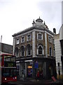
Halifax Brixton Road, formerly the Black Horse Public House
Image: © PAUL FARMER
Taken: 26 Feb 2011
0.04 miles
10
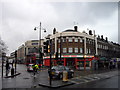
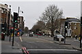
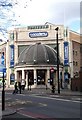
Payday Loans on corner of Brixton and Stockwell Roads
To the left of the picture in Stockwell Road is the O2 Academy
Image: © PAUL FARMER
Taken: 26 Feb 2011
0.05 miles