
IMAGES TAKEN NEAR TO
Loughborough Road, LONDON, SW9 7EJ
Introduction
This page details the photographs taken nearby to Loughborough Road, SW9 7EJ by members of the Geograph project.
The Geograph project started in 2005 with the aim of publishing, organising and preserving representative images for every square kilometre of Great Britain, Ireland and the Isle of Man.

There are currently over 7.5m images from over14,400 individuals and you can help contribute to the project by visiting https://www.geograph.org.uk
Image Map
Images are licensed for reuse under creativecommons.org/licenses/by-sa/2.0
Notes
- Clicking on the map will re-center to the selected point.
- The higher the marker number, the further away the image location is from the centre of the postcode.
Image Listing (47 Images Found)
Images are licensed for reuse under creativecommons.org/licenses/by-sa/2.0
Image
Details
Distance
1
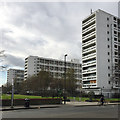
High-rise blocks, Loughborough Estate, Camberwell, south London
The view is across Loughborough Road and the Wyck Gardens open space. From right to left the blocks of maisonettes are Woolley House, Kettleby House and Kemble House. Barrington Road runs by the other ends of them. 19th-century maps show an area of small detached houses with gardens, large semi-detached houses and terraces – Angell Town. By 1951 some of the area had been cleared. These and other blocks first appear on a map of the period 1954-62. Magnificent. Links: http://www.urban75.org/brixton/history/loughborough4.html http://www.ideal-homes.org.uk/lambeth/lambeth-assets/galleries/brixton/loughborough-est Sadly, the Municipal Dreams website has nothing on the Loughborough Estate https://municipaldreams.wordpress.com//?s=Loughborough+estate&search=Go
Image: © Robin Stott
Taken: 20 Feb 2017
0.05 miles
2
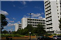
The Loughborough Estate, looking west from Loughborough Road
Image: © Christopher Hilton
Taken: 1 Jul 2011
0.06 miles
5
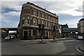
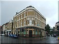
Green Man, Loughborough Junction, south of Camberwell, south London
The smart former Green Man pub is now a Lambeth Council Skills Zone. Nine roads and four railway lines share the same space.
Image: © Robin Stott
Taken: 20 Feb 2017
0.08 miles
6
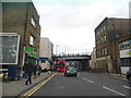
Coldharbour Lane, Loughborough Junction
The station of that name is under the bridges, the name coming from the multiple railway crossing partly seen here which was near Loughborough House, on the border of Brixton and Camberwell.
Image: © David Howard
Taken: 30 Dec 2012
0.08 miles
7
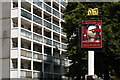
The "Hero of Switzerland" pub and Loughborough Estate flats, Loughborough Road
There has been a "Hero of Switzerland" pub on this site since at least 1901 (see relevant issue of Kelly's "Post Office London"), although this building clearly dates from the same post-war period as the flats around it.
Image: © Christopher Hilton
Taken: 1 Jul 2011
0.08 miles
8
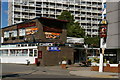
The "Hero of Switzerland" pub, Loughborough Road
There has been a "Hero of Switzerland" pub on this site since at least 1901 (see relevant issue of Kelly's "Post Office London"), although this building clearly dates from the same post-war period as the flats around it.
Image: © Christopher Hilton
Taken: 1 Jul 2011
0.08 miles
9
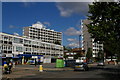
The Loughborough Estate, looking north-west along Loughborough Road
In the distance, the Hero of Switzerland pub (Image). There has been a "Hero of Switzerland" pub on this site since at least 1901 (see relevant issue of Kelly's "Post Office London"), although this building clearly dates from the same post-war period as the flats around it.
Image: © Christopher Hilton
Taken: 1 Jul 2011
0.08 miles
10
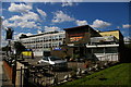
The "Hero of Switzerland" pub, Loughborough Road
There has been a "Hero of Switzerland" pub on this site since at least 1901 (see relevant issue of Kelly's "Post Office London"), although this building clearly dates from the same post-war period as the flats around it.
Image: © Christopher Hilton
Taken: 1 Jul 2011
0.08 miles