
IMAGES TAKEN NEAR TO
Henry Road, LONDON, SW9 7BQ
Introduction
This page details the photographs taken nearby to Henry Road, SW9 7BQ by members of the Geograph project.
The Geograph project started in 2005 with the aim of publishing, organising and preserving representative images for every square kilometre of Great Britain, Ireland and the Isle of Man.

There are currently over 7.5m images from over14,400 individuals and you can help contribute to the project by visiting https://www.geograph.org.uk
Image Map
Images are licensed for reuse under creativecommons.org/licenses/by-sa/2.0
Notes
- Clicking on the map will re-center to the selected point.
- The higher the marker number, the further away the image location is from the centre of the postcode.
Image Listing (169 Images Found)
Images are licensed for reuse under creativecommons.org/licenses/by-sa/2.0
Image
Details
Distance
1

Camberwell, vent shafts
On Akerman Road.
Image: © Mike Faherty
Taken: 24 Jun 2014
0.06 miles
2
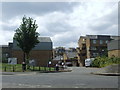
Myatts Fields Estate, SW9
The Myatts Fields Estate is a council estate in the London Borough of Lambeth. It is divided into Myatts North and Myatts South. This view shows the entrance into Myatts North, from Akerman Road.
Image: © Malc McDonald
Taken: 30 May 2011
0.06 miles
3
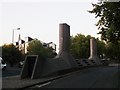
Weird object in Ackerman Road
Ackerman Road leads from Loughborough Road towards Lothian Road.
Apparently known locally as the 'Camberwell Submarine' (for obvious reasons!) It is a vent shaft for a subterranean boiler room. The high pressure gas boilers are used to heat two council estates nearby.
See http://www.urban75.org/london/camberwell-submarine.html for amazing images inside it.
Image: © David Anstiss
Taken: 2 Oct 2011
0.06 miles
4
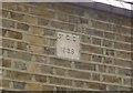
Old Boundary Marker by Akerman Road, Camberwell and Dulwich Parish
Estate Boundary Marker by the UC road, in parish of Camberwell and Dulwich (Southwark District), Akerman Road SW9, on high perimeter wall of college grounds behind railings.
Surveyed
Milestone Society National ID: SY_SGC23em.
Image: © Milestone Society
Taken: Unknown
0.07 miles
5
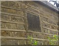
Old Boundary Marker by Akerman Road, Camberwell
Estate Boundary Marker by the UC road, in parish of Camberwell and Dulwich (Southwark District), Akerman Road SW9, on college boundary wall beneath 5 storey block.
Surveyed
Milestone Society National ID: SY_SGC25em
Image: © Milestone Society
Taken: Unknown
0.07 miles
7
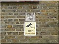
Old Boundary Marker by Akerman Street, Camberwell and Dulwich
Estate Boundary Marker by the UC road, in parish of Camberwell and Dulwich (Southwark District), Akerman Road SW9, on college wall above CCTV warning sign.
Surveyed
Milestone Society National ID: SY_SGC24em
Image: © Milestone Society
Taken: Unknown
0.09 miles
8
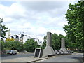
Akerman Road, SW9
Akerman Road passes through the Myatts Fields housing estate. The estate was built with a communal heating system. This structure in the centre of the road comprises air ventilation shafts and access to the boiler room.
Visible in the centre of the image, to the left of the ventilation shaft, is the top of a tower block on Brandon Estate (see Image), while further in the distance behind it, the three circles are at the top of the Strata tower, a newly-built tower block at Elephant & Castle (see Image).
Image: © Malc McDonald
Taken: 30 May 2011
0.09 miles
10
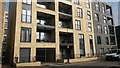
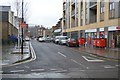
New build housing at the Oval Quarter
Image: © David Martin
Taken: 11 Mar 2016
0.10 miles