
IMAGES TAKEN NEAR TO
Sorrell Close, Myatts Fields South, LONDON, SW9 6ND
Introduction
This page details the photographs taken nearby to Sorrell Close, Myatts Fields South, SW9 6ND by members of the Geograph project.
The Geograph project started in 2005 with the aim of publishing, organising and preserving representative images for every square kilometre of Great Britain, Ireland and the Isle of Man.

There are currently over 7.5m images from over14,400 individuals and you can help contribute to the project by visiting https://www.geograph.org.uk
Image Map
Images are licensed for reuse under creativecommons.org/licenses/by-sa/2.0
Notes
- Clicking on the map will re-center to the selected point.
- The higher the marker number, the further away the image location is from the centre of the postcode.
Image Listing (87 Images Found)
Images are licensed for reuse under creativecommons.org/licenses/by-sa/2.0
Image
Details
Distance
1
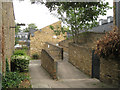
Pedestrian ramp, Urlwin Walk, Myatts Fields South estate
From the elevated west and north sides of the estate, ramps descend to a more conventional estate layout at ground level.
Image: © Robin Stott
Taken: 23 Jun 2013
0.05 miles
2
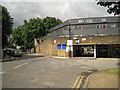
West corner of Myatts Fields South estate
Evandale Road, foreground and left; Urlwin Walk, right.
Image: © Robin Stott
Taken: 23 Jun 2013
0.05 miles
3
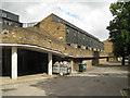
Urlwin Walk, Myatts Fields South estate
The form of Urlwin Walk reads as a defensive wall. Inside the wall is fairly conventional two-storey housing at ground level.
Image: © Robin Stott
Taken: 23 Jun 2013
0.06 miles
4
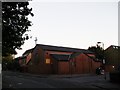
Mostyn Road Methodist Church
On the junction of Mostyn Road (on the left) and St Lawrence Way (on the right).
Image: © David Anstiss
Taken: 2 Oct 2011
0.09 miles
5
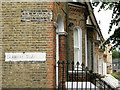
Northwest corner of Claribel Road
At its junction with Burton Road. Note the pleasing brick detailing.
Image: © Robin Stott
Taken: 23 Jun 2013
0.10 miles
6
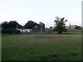
Mostyn Gardens Recreational Gardens
As seen from Mostyn Road.
In the background is the spire of Image
Image: © David Anstiss
Taken: 2 Oct 2011
0.11 miles
7
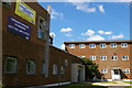
Iveagh Health Centre, Loughborough Road
A splendid 1950s building, capturing that optimistic moment of welfare state modernism.
Image: © Christopher Hilton
Taken: 1 Jul 2011
0.11 miles
8
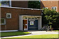
Iveagh Health Centre, Loughborough Road
A splendid 1950s building, capturing that optimistic moment of welfare state modernism.
Image: © Christopher Hilton
Taken: 1 Jul 2011
0.11 miles
9
Iveagh Health Centre, Loughborough Road
A splendid 1950s building, capturing that optimistic moment of welfare state modernism.
Image: © Christopher Hilton
Taken: 1 Jul 2011
0.11 miles
10
Iveagh Health Centre, Loughborough Road
A splendid 1950s building, capturing that optimistic moment of welfare state modernism.
Image: © Christopher Hilton
Taken: 1 Jul 2011
0.11 miles