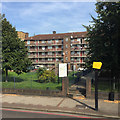
IMAGES TAKEN NEAR TO
Gosling Way, LONDON, SW9 6LT

Introduction

This page details the photographs taken nearby to Gosling Way, SW9 6LT by members of the Geograph project.

The Geograph project started in 2005 with the aim of publishing, organising and preserving representative images for every square kilometre of Great Britain, Ireland and the Isle of Man.

There are currently over 7.5m images from over14,400 individuals and you can help contribute to the project by visiting https://www.geograph.org.uk

Image Map


Images are licensed for reuse under creativecommons.org/licenses/by-sa/2.0
Notes
  • Clicking on the map will re-center to the selected point.
  • The higher the marker number, the further away the image location is from the centre of the postcode.

Image Listing (119 Images Found)

Images are licensed for reuse under creativecommons.org/licenses/by-sa/2.0
  • ...
Image
Details
Distance
1
Brixton Rd, A23
Image: © N Chadwick Taken: 3 Feb 2018
0.02 miles
2
Cowley Estate flats facing Brixton Road, Angell Town, south London
The view from a no.3 bus, Crystal Palace-Trafalgar Square.
Image: © Robin Stott Taken: 28 Aug 2017
0.02 miles
3
Cowley Estate
Image: © N Chadwick Taken: 3 Feb 2018
0.04 miles
4
Brixton Rd, A23
Image: © N Chadwick Taken: 3 Feb 2018
0.04 miles
5
152-160 Brixton Road
A lofty four-storey terrace, plus basements, much restored and curtailed, having lost its north end and therefore its symmetry. Grade II listed. Note Spiderman showing off.
Image: © Stephen Richards Taken: 27 Apr 2013
0.04 miles
6
Blocks of flats on Brixton Road
These are privately owned.
Image: © Bill Boaden Taken: 31 Jan 2014
0.05 miles
7
Cowley Estate
Social housing from an independent supplier. Most locally are owned by the Borough of Lambeth.
Image: © Bill Boaden Taken: 31 Jan 2014
0.06 miles
8
Macartney House, SW9
These flats are near the corner of Brixton Road and Vassall Road, Stockwell. They are a variation on the design commonly seen in residential areas in Inner London, with metal fencing along the front of the balcony, as opposed to a brick wall. Almost always they are 5 stories high, with a long balcony at the front. They were built as Council Flats. See this picture of mine for another design on the same theme http://www.geograph.org.uk/photo/179361
Image: © Danny P Robinson Taken: 1 Jun 2006
0.06 miles
9
Cowley Estate: beside the Brixton Road
Image: © David Martin Taken: 29 Jan 2023
0.06 miles
10
Brixton Road
Looking towards Brixton as a 133 bus, on its way from Liverpool Street to Streatham, draws up at a stop. One of London's lost rivers, the Effra, used to flow alongside this road but has long been incorporated into the sewage network.
Image: © Stephen McKay Taken: 20 Oct 2015
0.07 miles
  • ...