
IMAGES TAKEN NEAR TO
Clapham Road, LONDON, SW9 0JD
Introduction
This page details the photographs taken nearby to Clapham Road, SW9 0JD by members of the Geograph project.
The Geograph project started in 2005 with the aim of publishing, organising and preserving representative images for every square kilometre of Great Britain, Ireland and the Isle of Man.

There are currently over 7.5m images from over14,400 individuals and you can help contribute to the project by visiting https://www.geograph.org.uk
Image Map
Images are licensed for reuse under creativecommons.org/licenses/by-sa/2.0
Notes
- Clicking on the map will re-center to the selected point.
- The higher the marker number, the further away the image location is from the centre of the postcode.
Image Listing (226 Images Found)
Images are licensed for reuse under creativecommons.org/licenses/by-sa/2.0
Image
Details
Distance
1
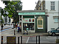
Beauty Clinic
On the corner of Claylands Road and Clapham Road (A3). The main interest is the tiled panel for John Lovibond. This brewery was based in Greenwich, with many 'shops' for local sales - they did not seem to run pubs. The 'shops' were presumably off-licences, and this panel suggests this was once one.
Image: © Robin Webster
Taken: 23 Jul 2011
0.02 miles
2

15-41 Clapham Road
An early C19th terrace, not entirely uniform like most of Clapham Road's Georgian terraces. The round-headed ground-floor windows are characteristic of late Georgian builders. Grade II listed.
Mostly still residential although the corner building is a dental surgery.
Image: © Stephen Richards
Taken: 11 Mar 2012
0.03 miles
3
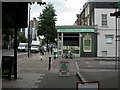
Oval, pub tiles
At the junction of Clapham & Claylands Roads, a fine tiled plaque, presumably on the site of a former pub; advertising a long-gone brewery.
Image: © Mike Faherty
Taken: 22 Aug 2009
0.04 miles
4
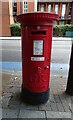
George V postbox on Clapham Road
Postbox No. SW9 9.
Image: © JThomas
Taken: 29 Jul 2022
0.05 miles
6
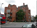
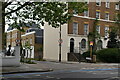
Oval, Belgrave Children's Hospital
Former children's hospital on Clapham Road, built 1899-1926, closed 1985, converted to flats. http://www.kcl.ac.uk/depsta/iss/archives/collect/10be50-1.html
Image: © Mike Faherty
Taken: 22 Aug 2009
0.06 miles
8
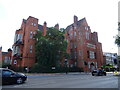
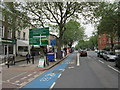
Former Belgrave Hospital for Children
A Grade II* listed building which is currently residential flats.
Image: © JThomas
Taken: 29 Jul 2022
0.06 miles
9
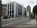
South Lambeth, Frank O'Neill House
Lambeth Police Command building on Clapham Road, named after a PC killed on duty in 1980.
Image: © Mike Faherty
Taken: 22 Aug 2009
0.06 miles
10
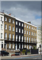
60-66 Clapham Road
A very stately late Georgian terrace, each house of four storeys over a basement and three bays wide, and a continuous cast-iron balcony. Early C19th. Grade II listed.
Image: © Stephen Richards
Taken: 15 Apr 2012
0.07 miles