IMAGES TAKEN NEAR TO
Wyvil Road, LONDON, SW8 2TB
Introduction
This page details the photographs taken nearby to Wyvil Road, SW8 2TB by members of the Geograph project.
The Geograph project started in 2005 with the aim of publishing, organising and preserving representative images for every square kilometre of Great Britain, Ireland and the Isle of Man.

There are currently over 7.5m images from over14,400 individuals and you can help contribute to the project by visiting https://www.geograph.org.uk
Image Map
Images are licensed for reuse under creativecommons.org/licenses/by-sa/2.0
Notes
- Clicking on the map will re-center to the selected point.
- The higher the marker number, the further away the image location is from the centre of the postcode.
Image Listing (135 Images Found)
Images are licensed for reuse under creativecommons.org/licenses/by-sa/2.0
Image
Details
Distance
1
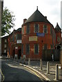
Community Centre, Wheatsheaf Lane, SW8
This was built in 1896 as a church. It is now a community centre with a hall open to hire to anyone for any purpose, not just religious groups. It is used by two independent churches - one of them is a Portuguese language church and the other denomination is the Unity Baptist Church.
Image: © Danny P Robinson
Taken: 19 Oct 2007
0.03 miles
2
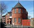
Community hall, Wheatsheaf Lane
Dated 1896 when it was built as a Congregational mission hall. Grade II listed.
Image: © Stephen Richards
Taken: 21 Apr 2013
0.05 miles
3
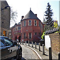
Wheatsheaf Hall Community Centre, Wheatsheaf Lane
A former Congregational mission hall of 1896, grade II listed.
Image: © Robin Webster
Taken: 19 Apr 2019
0.05 miles
4
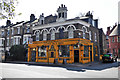
Tia Maria Bar and Kitchen, South Lambeth Road
Clearly a gentrified pub, and 'Wheatsheaf Lane' down the side is a pretty good clue as to what it was called.
Image: © Robin Webster
Taken: 19 Apr 2019
0.06 miles
5

Shops and Flats on South Lambeth Road.
This is near the junction with Old South Lambeth Road. The flats are Victoria House and Victoria Mansions. Many of the shops and eating places here have a Portuguese connection.
Image: © Danny P Robinson
Taken: 19 Oct 2007
0.06 miles
6
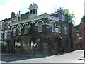
The Wheatsheaf, Vauxhall
Former pub now trading as a Brazilian restaurant called Tia Maria.
Image: © Chris Whippet
Taken: 19 Jul 2015
0.06 miles
7
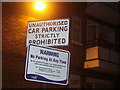
Old and new car parking signs, Luscombe Way
An original and recent sign telling visitors exactly the same thing in different ways.
Image: © David Howard
Taken: 22 Jun 2009
0.07 miles
8
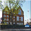
Wyvil Primary School
This is the end of a quite large building.
Image: © Robin Webster
Taken: 19 Apr 2019
0.07 miles
9
Banham Burglary Prevention, Wandsworth Rd
Image: © N Chadwick
Taken: 2 Jul 2011
0.07 miles