
IMAGES TAKEN NEAR TO
Paragon Mews, LONDON, SW8 1FU
Introduction
This page details the photographs taken nearby to Paragon Mews, SW8 1FU by members of the Geograph project.
The Geograph project started in 2005 with the aim of publishing, organising and preserving representative images for every square kilometre of Great Britain, Ireland and the Isle of Man.

There are currently over 7.5m images from over14,400 individuals and you can help contribute to the project by visiting https://www.geograph.org.uk
Image Map
Images are licensed for reuse under creativecommons.org/licenses/by-sa/2.0
Notes
- Clicking on the map will re-center to the selected point.
- The higher the marker number, the further away the image location is from the centre of the postcode.
Image Listing (219 Images Found)
Images are licensed for reuse under creativecommons.org/licenses/by-sa/2.0
Image
Details
Distance
2
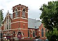
Former Methodist Church, Fentiman Road
Designed by George and Reginald Baines in 1900 in the "usual jolly style of the Methodists" (Pevsner). It is in the Gothic Perpendicular style and built of red brick with stone dressings. It has a tower with crenellated battlements, and a large traceried window with trefoils and pinnacles. Grade II listed.
Image: © Stephen Richards
Taken: 23 Jul 2009
0.06 miles
3
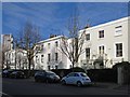
Fentiman Road, SW8 (6)
The north side, west of Meadow Road.
Image: © Mike Quinn
Taken: 17 Jan 2018
0.06 miles
5
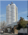
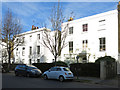
Sirinham Point, Meadow Road
Sister to, and contemporary with, Image Its sister will no doubt be similarly re-clad.
Image: © Stephen Richards
Taken: 21 Apr 2013
0.06 miles
6
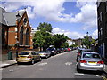
Meadow Road
The church on the left is The Calvary Church of God in Christ in Fentiman Road
Image: © PAUL FARMER
Taken: 17 May 2009
0.06 miles
7
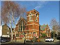
The Calvary Church of God in Christ, Fentiman Road / Meadow Road, SW8
The building, originally a Methodist church, is Grade II listed https://www.historicengland.org.uk/listing/the-list/list-entry/1031564 .
Image: © Mike Quinn
Taken: 17 Jan 2018
0.06 miles
8
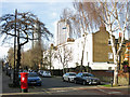
Fentiman Road, SW8 (5)
The north side, west of Meadow Road. Shows the location of Image
Image: © Mike Quinn
Taken: 17 Jan 2018
0.06 miles
10
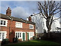
Caron Almshouses, Fentiman Road
The present almshouses date from 1854. Prior to that the almshouses were in Wandsworth Road and dated from 1618. A full history can be seen at vauxhallhistory.org/caron-almshouses/ Only half of the almshouses are visible in this view.
Image: © Marathon
Taken: 26 Feb 2024
0.06 miles