IMAGES TAKEN NEAR TO
Ranelagh Gardens, LONDON, SW6 3UE
Introduction
This page details the photographs taken nearby to Ranelagh Gardens, SW6 3UE by members of the Geograph project.
The Geograph project started in 2005 with the aim of publishing, organising and preserving representative images for every square kilometre of Great Britain, Ireland and the Isle of Man.

There are currently over 7.5m images from over14,400 individuals and you can help contribute to the project by visiting https://www.geograph.org.uk
Image Map
Images are licensed for reuse under creativecommons.org/licenses/by-sa/2.0
Notes
- Clicking on the map will re-center to the selected point.
- The higher the marker number, the further away the image location is from the centre of the postcode.
Image Listing (715 Images Found)
Images are licensed for reuse under creativecommons.org/licenses/by-sa/2.0
Image
Details
Distance
1
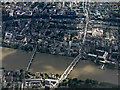
Putney from the air
Putney road bridge is on the right, Putney railway bridge is on the left.
Image: © Thomas Nugent
Taken: 22 Jun 2015
0.02 miles
2
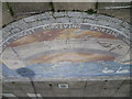
Close up of artwork commemorating the University Boat Race
This attractive piece of artwork is next to the Thames Path between Putney Bridge and Putney Railway Bridge. A view of its location can be seen at http://www.geograph.org.uk/photo/3427464
Image: © Marathon
Taken: 17 Apr 2013
0.02 miles
3
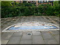
Boat Race Art Work
Alongside the Thames Path between Putney Bridge and Putney Railway Bridge
Image: © Eirian Evans
Taken: 15 Aug 2013
0.02 miles
4
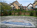
Artwork commemorating the University Boat Race
This attractive piece of artwork is next to the Thames Path between Putney Bridge and Putney Railway Bridge. A close up can be seen at http://www.geograph.org.uk/photo/3427469
Image: © Marathon
Taken: 17 Apr 2013
0.02 miles
5
Looking across The Thames from Putney Wharf
Just after sundown and the light from a full moon illuminates the evening clouds.
Image: © Neil Theasby
Taken: 23 Jan 2016
0.02 miles
6
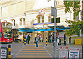
Entrance to Putney Bridge Station
View eastward on Station Approach, off Putney High Street, off Putney Bridge Approach, in Fulham. The station, which has a rather complex history, is a major stop on the Earls Court - Wimbledon division of the London Underground District Line. The photograph reveals features signs of the past (1880 station architecture) and the present: note the new bus - and who was the 'Heathrow Sex Slave'?
Image: © Ben Brooksbank
Taken: 3 Nov 2006
0.03 miles
7

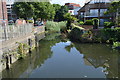
Swan Drawdock
Now a nature reserve, this inlet is seen from the Thames Path crossing a bridge over its mouth. There was a pub called the Swan here, and adjacent wharves included Carrara Wharf, now the name of the housing development on the right. The walls on the left are perhaps on the site of the toll-house for Fulham Bridge, a wooden bridge built across the Thames in 1729 and replaced by Putney Bridge in 1886 http://www.hfhbg.org.uk/newsletters/Newsletter-22-Spr-10.pdf . The somewhat unattractive contribution to the scene in the left background is Putney Bridge Premier Inn.
Image: © Derek Harper
Taken: 3 Aug 2012
0.03 miles
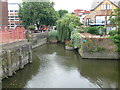
9
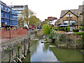
Old drawdock, Carrara Wharf, Fulham
Viewed from a modern footbridge, this is now blocked to navigation and only semi-tidal. This was subject to an archaeological survey in 2009 - see http://www.thamesdiscovery.org/frog-blog/frog-survey-at-carrara-wharf . Immediately on the left was the approach to the multi-span timber Fulham Bridge. This was replaced by Putney Bridge in 1886 and then demolished.
Image: © Robin Webster
Taken: 14 Apr 2012
0.03 miles