IMAGES TAKEN NEAR TO
Pearscroft Road, LONDON, SW6 2BB
Introduction
This page details the photographs taken nearby to Pearscroft Road, SW6 2BB by members of the Geograph project.
The Geograph project started in 2005 with the aim of publishing, organising and preserving representative images for every square kilometre of Great Britain, Ireland and the Isle of Man.

There are currently over 7.5m images from over14,400 individuals and you can help contribute to the project by visiting https://www.geograph.org.uk
Image Map
Images are licensed for reuse under creativecommons.org/licenses/by-sa/2.0
Notes
- Clicking on the map will re-center to the selected point.
- The higher the marker number, the further away the image location is from the centre of the postcode.
Image Listing (96 Images Found)
Images are licensed for reuse under creativecommons.org/licenses/by-sa/2.0
Image
Details
Distance
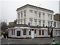
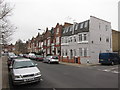
2
Sands End: The Queen Elizabeth public house
This Victorian public house is at 58 Pearscroft Road, SW6.
Comparing the 1874 and 1896 Editions of the Ordnance Survey 1:10,560 scale mapping shows the great change that took place in Sands End between those two dates. In 1874 there were virtually no houses but lots of orchards, but by 1896 certainly the whole area from Bagley's Lane (in the foreground here) westwards had been developed for housing. The pub would have stood at the edge of that development. Curiously the 1896 map shows Pearscroft Road to be Victoria Road, but by the time the 1920 Edition was published it had changed to its present name.
Image: © Nigel Cox
Taken: 22 Jun 2008
0.03 miles
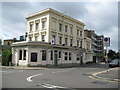
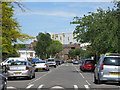
3
Sands End Gasworks
The gasworks was originally built in the 19th century to provide lighting for the boroughs of Hammersmith and Fulham, and was known then as the Imperial Gas Works. The current configuration of gasometers was certainly in place by 1896. This view was taken looking down Fulmead Street across Imperial Road.
Image: © Nigel Cox
Taken: 22 Jun 2008
0.06 miles
4
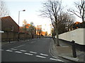
Fulmead Street at the junction of Bagleys Lane
Image: © David Howard
Taken: 16 Mar 2014
0.06 miles
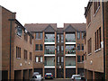
8
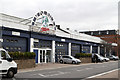
Imperial Studios
A set of industrial units on Imperial Road housing, among other things, a fitness class.
Image: © Martin Addison
Taken: 19 Apr 2013
0.09 miles
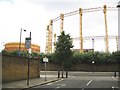
9
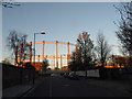
Gas Holder by Imperial Road
From Fulmead Street
Image: © David Howard
Taken: 16 Mar 2014
0.09 miles