IMAGES TAKEN NEAR TO
Merrington Road, LONDON, SW6 1RW
Introduction
This page details the photographs taken nearby to Merrington Road, SW6 1RW by members of the Geograph project.
The Geograph project started in 2005 with the aim of publishing, organising and preserving representative images for every square kilometre of Great Britain, Ireland and the Isle of Man.

There are currently over 7.5m images from over14,400 individuals and you can help contribute to the project by visiting https://www.geograph.org.uk
Image Map
Images are licensed for reuse under creativecommons.org/licenses/by-sa/2.0
Notes
- Clicking on the map will re-center to the selected point.
- The higher the marker number, the further away the image location is from the centre of the postcode.
Image Listing (264 Images Found)
Images are licensed for reuse under creativecommons.org/licenses/by-sa/2.0
Image
Details
Distance
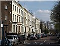
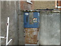
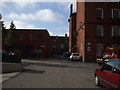
3
Sedlescombe Road
Property on Sedlescombe Road seen from the Ibis Hotel.
Image: © Peter McDermott
Taken: 30 Jun 2014
0.06 miles
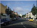
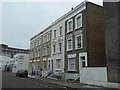
4
Ongar Road, West Brompton
A three-storey terrace catches the sun to advantage in this view from across Lille Road.
Image: © Derek Harper
Taken: 15 Apr 2010
0.07 miles
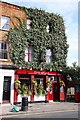
5
Boom, boom, boom, Esso Blue
Those of us who are over a certain age may remember paraffin machines where you placed a gallon container under a nozzle in the base of the machine, put in a token and watch it fill up. Ah what memories......
Corner of Tamworth Street & Sedlescombe Road, SW6.
Image: © Phillip Perry
Taken: 4 Aug 2008
0.07 miles
6
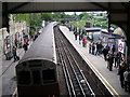
West Brompton station - an under-used interchange
This photograph shows the London Transport District Line station, with a southbound train of D78 stock just departing for Wimbledon. To the right is the main line station, which was closed in 1940 and later demolished, but in the late 1990s it was rebuilt and reopened. It now has an hourly service each way from Brighton to Watford Junction, and a half-hourly service from Clapham Junction to Willesden Junction. If more passengers were aware of the convenience of this interchange, it would see much heavier use.
Image: © Dr Neil Clifton
Taken: 25 May 2006
0.08 miles
7
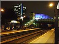
West Brompton Station
With the Empress building and Earls Court 2 lit up in the background
Image: © Martyn Davies
Taken: 17 Oct 2006
0.08 miles
9
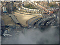
Earl's Court from the air
The exhibition halls have been demolished.
See the same scene over the years...
October 2011 Image
November 2014 Image
July 2015 Image
July 2015 Image
August 2015 Image
August 2016 Image
Image: © Thomas Nugent
Taken: 28 Feb 2019
0.08 miles
10
Peabody Trust buildings II, Lillie Road, SW6
Inside Peabody Trust buildings, Lillie Road, SW6. See also Image The new buildings on the left are on the site of the old Beaufort House primary school.
Image: © Phillip Perry
Taken: 4 Aug 2008
0.08 miles