IMAGES TAKEN NEAR TO
North End Road, LONDON, SW6 1NL
Introduction
This page details the photographs taken nearby to North End Road, SW6 1NL by members of the Geograph project.
The Geograph project started in 2005 with the aim of publishing, organising and preserving representative images for every square kilometre of Great Britain, Ireland and the Isle of Man.

There are currently over 7.5m images from over14,400 individuals and you can help contribute to the project by visiting https://www.geograph.org.uk
Image Map
Images are licensed for reuse under creativecommons.org/licenses/by-sa/2.0
Notes
- Clicking on the map will re-center to the selected point.
- The higher the marker number, the further away the image location is from the centre of the postcode.
Image Listing (121 Images Found)
Images are licensed for reuse under creativecommons.org/licenses/by-sa/2.0
Image
Details
Distance
1
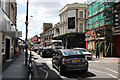
North End Road
The incredibly busy B317 seen from the junction with Lillie Road (A3218).
Image: © Martin Addison
Taken: 11 Jun 2014
0.01 miles
2
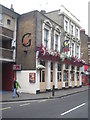
The Goose public house in North End Road Fulham
Image: © Rod Allday
Taken: 3 Sep 2011
0.01 miles
3
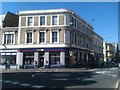
Junction of Lillie Road and North End Road
Image: © David Martin
Taken: 26 Mar 2012
0.02 miles
4
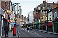
Lillie Road, Fulham
Seen close to the junction with North End Road.
Image: © Peter Trimming
Taken: 4 Feb 2016
0.02 miles
5
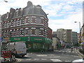
Lillie Road SW6
Looking across the junction with North End Road SW6
Image: © Robin Sones
Taken: 26 Aug 2009
0.03 miles
6
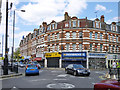
Shops at corner of North End Road and Lillie Road
Image: © Robin Webster
Taken: 13 May 2012
0.03 miles
7
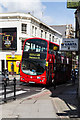
28 to Wandsworth
Once one of the longest routes in London stretching from Golders Green to Kingston Vale the route was split in the late 1980's to improve reliability. After a number of subsequent changes the route currently runs between Kensal Rise and Wandsworth. The route has a special timetable on days when Chelsea FC are playing at home. Here is one of Tower Transit's Volvo B7TL vehicles on North End Road - a bottleneck of congestion along the route.
Image: © Martin Addison
Taken: 11 Jun 2014
0.03 miles
8
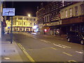
Lillie Road, SW6
Lillie Road looking towards North End Road.
Image: © Phillip Perry
Taken: 9 Jun 2008
0.03 miles
9
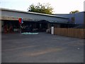
Normand Croft community school II, SW6
From when it opened c.1958 until around 2004, it was originally known as Normand Park primary school, it then merged with the Bramber Road nursery next door to become Normand Croft community school. This building was the 'infant school'. Until merging, the nursery although being on the same site was entirely separate.
Apart from some cosmetic changes, the new building on the right and the shrinking playground, this place looks unchanged since I left this part of the building almost 40 years ago.
Image: © Phillip Perry
Taken: 21 Sep 2010
0.04 miles