IMAGES TAKEN NEAR TO
Earl's Court Square, LONDON, SW5 9DJ
Introduction
This page details the photographs taken nearby to Earl's Court Square, SW5 9DJ by members of the Geograph project.
The Geograph project started in 2005 with the aim of publishing, organising and preserving representative images for every square kilometre of Great Britain, Ireland and the Isle of Man.

There are currently over 7.5m images from over14,400 individuals and you can help contribute to the project by visiting https://www.geograph.org.uk
Image Map
Images are licensed for reuse under creativecommons.org/licenses/by-sa/2.0
Notes
- Clicking on the map will re-center to the selected point.
- The higher the marker number, the further away the image location is from the centre of the postcode.
Image Listing (477 Images Found)
Images are licensed for reuse under creativecommons.org/licenses/by-sa/2.0
Image
Details
Distance

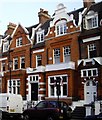
3
View up Earls Court Square #2
Looking north-northeast.
Image: © Robert Lamb
Taken: 14 Jun 2014
0.03 miles
4

View up Earls Court Road
Looking north-northwest.
Image: © Robert Lamb
Taken: 14 Jun 2014
0.03 miles

7
430 bus in Old Brompton Road, Earl's Court
Image: © PAUL FARMER
Taken: 21 Jan 2011
0.05 miles
10
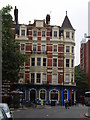
O'Neills, Old Brompton Road SW10
At the junction of Earl's Court Road. Taken from Redcliffe Gardens. The entrance to the pub is in Earl's Court Road and therefore in SW5. The pub was formerly called The Bolton.
Image: © Robin Sones
Taken: 11 Jun 2010
0.05 miles