IMAGES TAKEN NEAR TO
Lessar Avenue, LONDON, SW4 9HN
Introduction
This page details the photographs taken nearby to Lessar Avenue, SW4 9HN by members of the Geograph project.
The Geograph project started in 2005 with the aim of publishing, organising and preserving representative images for every square kilometre of Great Britain, Ireland and the Isle of Man.

There are currently over 7.5m images from over14,400 individuals and you can help contribute to the project by visiting https://www.geograph.org.uk
Image Map
Images are licensed for reuse under creativecommons.org/licenses/by-sa/2.0
Notes
- Clicking on the map will re-center to the selected point.
- The higher the marker number, the further away the image location is from the centre of the postcode.
Image Listing (193 Images Found)
Images are licensed for reuse under creativecommons.org/licenses/by-sa/2.0
Image
Details
Distance
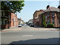
2
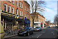
The Abbeville on Abbeville Road, Clapham
Image: © Roger Davies
Taken: 9 Feb 2014
0.09 miles
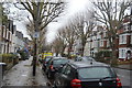
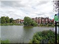
6

Flats, Clapham Common South Side
Reflected in Eagle Pond, Clapham Common
Image: © Chris Reynolds
Taken: 7 Aug 2009
0.10 miles
8
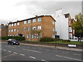
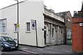
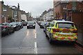
Clapham Park: Klea Avenue and police station
Image: © Dr Neil Clifton
Taken: 13 Jul 2013
0.10 miles
9
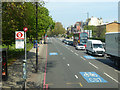
A24 Clapham Common South Side
Looking from the northbound Lynette Avenue bus stop. Clapham Common is on the left.
Image: © Robin Webster
Taken: 19 Apr 2019
0.10 miles
10
Eagle Pond, Clapham Common
Popular pond for fishing with Clapham Common South Side in the background
Image: © Paul Gillett
Taken: 4 Aug 2013
0.10 miles