
IMAGES TAKEN NEAR TO
Clapham Common West Side, LONDON, SW4 9AT
Introduction
This page details the photographs taken nearby to Clapham Common West Side, SW4 9AT by members of the Geograph project.
The Geograph project started in 2005 with the aim of publishing, organising and preserving representative images for every square kilometre of Great Britain, Ireland and the Isle of Man.

There are currently over 7.5m images from over14,400 individuals and you can help contribute to the project by visiting https://www.geograph.org.uk
Image Map
Images are licensed for reuse under creativecommons.org/licenses/by-sa/2.0
Notes
- Clicking on the map will re-center to the selected point.
- The higher the marker number, the further away the image location is from the centre of the postcode.
Image Listing (48 Images Found)
Images are licensed for reuse under creativecommons.org/licenses/by-sa/2.0
Image
Details
Distance
1
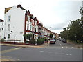
Clapham Common West Side
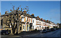
The houses in this image look out over Clapham Common.
Image: © Malc McDonald
Taken: 9 Jul 2016
0.02 miles
5
Clapham Common West Side
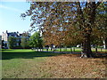
Clapham Common was originally two commons belonging to neighbouring parishes, with the western end here being called Battersea East Common. There was substantial disagreement over where the boundary lay and in 1716 the Battersea parishioners dug a ditch across the common to demarcate their portion. This was rapidly filled in. One of the reasons the common has survived is through its popularity with the wealthy and influential as a place to reside and hence protect from development. Many of their houses still surround the common, as here on Clapham Common West Side. In 1877, the common was bought by the Metropolitan Board of Works from the Lords of the Manors and designated as a Metropolitan Common "dedicated to and for the use and recreation of the public as an open and unenclosed space for ever". Clapham Common is one of the very few large Metropolitan Commons not to have been dissected by railway lines, but road-building has made up for this. The South Circular Road is just behind where I was standing.
Image: © Marathon
Taken: 2 Oct 2011
0.11 miles
6
London (Lambeth), 1987: after the October Hurricane
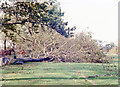
Scene by The Avenue (A205) Clapham Common, where almost all the trees were blown down: this a typical scene, two days later when you could at least get along the main roads.
Image: © Ben Brooksbank
Taken: 18 Oct 1987
0.12 miles
8
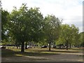
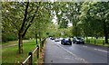
Trees along the South Circular Road over Clapham Common
Clapham Common is big enough to get away from the worst of the normal traffic noise, but the peaceful atmosphere is frequently interrupted by police and ambulance sirens.
Image: © Chris Reynolds
Taken: 29 Sep 2009
0.12 miles
9
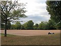
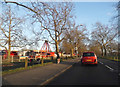
All weather playing area on Clapham Common
Image: © Chris Reynolds
Taken: 29 Sep 2009
0.13 miles
10
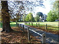
Clapham Common West Side
Clapham Common was originally two commons belonging to neighbouring parishes, with the western end here being called Battersea East Common. There was substantial disagreement over where the boundary lay and in 1716 the Battersea parishioners dug a ditch across the common to demarcate their portion. This was rapidly filled in. One of the reasons the common has survived is through its popularity with the wealthy and influential as a place to reside and hence protect from development. Many of their houses still surround the common, as here on Clapham Common West Side. In 1877, the common was bought by the Metropolitan Board of Works from the Lords of the Manors and designated as a Metropolitan Common "dedicated to and for the use and recreation of the public as an open and unenclosed space for ever". Clapham Common is one of the very few large Metropolitan Commons not to have been dissected by railway lines, but road-building has made up for this. The South Circular Road is just behind where I was standing.
Image: © Marathon
Taken: 2 Oct 2011
0.13 miles