IMAGES TAKEN NEAR TO
Rathmell Drive, LONDON, SW4 8JW
Introduction
This page details the photographs taken nearby to Rathmell Drive, SW4 8JW by members of the Geograph project.
The Geograph project started in 2005 with the aim of publishing, organising and preserving representative images for every square kilometre of Great Britain, Ireland and the Isle of Man.

There are currently over 7.5m images from over14,400 individuals and you can help contribute to the project by visiting https://www.geograph.org.uk
Image Map
Images are licensed for reuse under creativecommons.org/licenses/by-sa/2.0
Notes
- Clicking on the map will re-center to the selected point.
- The higher the marker number, the further away the image location is from the centre of the postcode.
Image Listing (51 Images Found)
Images are licensed for reuse under creativecommons.org/licenses/by-sa/2.0
Image
Details
Distance
1
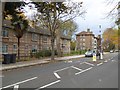
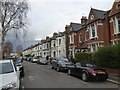
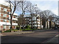
System-built houses and conventional apartments, Rodenhurst Road
Image: © David Smith
Taken: 17 Nov 2016
0.12 miles
2
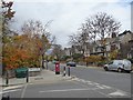
Rodenhurst Road and its junction with Hambalt Road
The pillar box on the corner is from the reign of King Edward VII
Image: © David Smith
Taken: 17 Nov 2016
0.12 miles
3
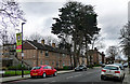
200-226 Rodenhurst Road
Unusual block of maisonettes (I think) with a pronounced external grid showing as if it were never properly finished.
Image: © Stephen Richards
Taken: 18 Mar 2020
0.13 miles
4
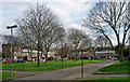
Morten Close
Low brick Deco-ish blocks arranged around three sides of a green.
Image: © Stephen Richards
Taken: 18 Mar 2020
0.14 miles
5
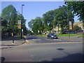
Clarence Avenue at the junction of Poynders Road
Image: © David Howard
Taken: 27 May 2012
0.15 miles
6
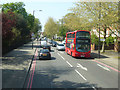
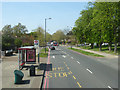
A205, Poynders Road, SW4
The South Circular Road.
Image: © Robin Webster
Taken: 19 Apr 2019
0.16 miles
7
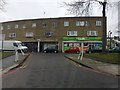
Shopping Precinct
Shopping precinct off Poynders Road.
Image: © Alan Hughes
Taken: 20 Jan 2018
0.16 miles
9
A205, Poynders Road, SW4
The South Circular Road by the westbound Poynders Road - Clarence Avenue bus stop.
Image: © Robin Webster
Taken: 19 Apr 2019
0.16 miles
10
Clapham Park, Oaklands Estate
1930s ex-GLC estate on Poynders Road; a conservation area. http://www.lambeth.gov.uk/Services/HousingPlanning/Planning/OaklandsEstateConservationArea.htm
Image: © Mike Faherty
Taken: 5 Dec 2009
0.17 miles