IMAGES TAKEN NEAR TO
Lendal Terrace, LONDON, SW4 7UX
Introduction
This page details the photographs taken nearby to Lendal Terrace, SW4 7UX by members of the Geograph project.
The Geograph project started in 2005 with the aim of publishing, organising and preserving representative images for every square kilometre of Great Britain, Ireland and the Isle of Man.

There are currently over 7.5m images from over14,400 individuals and you can help contribute to the project by visiting https://www.geograph.org.uk
Image Map
Images are licensed for reuse under creativecommons.org/licenses/by-sa/2.0
Notes
- Clicking on the map will re-center to the selected point.
- The higher the marker number, the further away the image location is from the centre of the postcode.
Image Listing (216 Images Found)
Images are licensed for reuse under creativecommons.org/licenses/by-sa/2.0
Image
Details
Distance
1
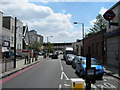
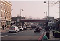
Bedford Road SW4
Outside Clapham North tube station. The railway bridge carries trains from Victoria to Kent and stations in SE London. Clapham High Street station is only a short walk away.
Image: © Danny P Robinson
Taken: 21 Jun 2006
0.00 miles
2
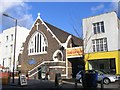
Car and soul wash
Bedford Road, Stockwell. The church was originally built around 1910 as the Epiphany Mission Church but since the early 1980's has been the Calvary Impact Church. The car wash next door provides an interesting contrast.
Image: © Stephen Craven
Taken: 21 Nov 2006
0.00 miles
4

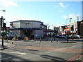
Road junction
Stockwell - Clapham road junction.
Image: © Alan Hughes
Taken: 11 Aug 2017
0.01 miles
5
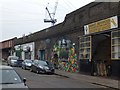
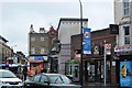
Lendal Terrace, Clapham
Some of the businesses under the arches of the railway bridge near Clapham High Street railway station. The decorated facade is of a night club
Image: © David Smith
Taken: 28 Nov 2013
0.02 miles
8

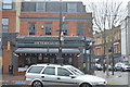
Charlie's Fish Bar, Bedford Road, SW4
Shows one of the ventilation shafts of the Clapham North deep shelter (south). See also Image
In late 1940, the government decided to build a system of deep (air raid) shelters linked to existing underground stations. Each deep shelter consisted of two parallel tubes that might be used for future express underground lines. Seven such shelters were built at Northern Line stations - Belsize Park, Camden Town, Goodge Street, Stockwell, Clapham North, Clapham Common and Clapham South. Each shelter had two entrances with a “pill box” and ventilation shafts; most of these are still there today (February 2011). Some of the deep shelters are in use for secure storage of documents.
This ventilation shaft can be seen on the satellite image http://wtp2.appspot.com/wheresthepath.htm?lat=51.46475106870353&lon=-0.12960433959960937&gz=19&oz=10>=1 . Unlike the other deep shelters on the Northern Line, here there is no pill box structure. [Source: “Beneath the City Streets” by Peter Laurie (1970, revised 1979).]
A view of Bedford Road is shown in Image photographed by Danny Robinson. The yard containing the two ventilation shafts is to the right of the white lorry.
Image: © Mike Quinn
Taken: 8 Feb 2011
0.02 miles
9

Clapham North deep shelter (south), Bedford Road, SW4 - ventilation shaft
In late 1940, the government decided to build a system of deep (air raid) shelters linked to existing underground stations. Each deep shelter consisted of two parallel tubes that might be used for future express underground lines. Seven such shelters were built at Northern Line stations - Belsize Park, Camden Town, Goodge Street, Stockwell, Clapham North, Clapham Common and Clapham South. Each shelter had two entrances with a “pill box” and ventilation shafts; most of these are still there today (February 2011). Some of the deep shelters are in use for secure storage of documents.
This ventilation shaft can be seen on the satellite image http://wtp2.appspot.com/wheresthepath.htm?lat=51.46475106870353&lon=-0.12960433959960937&gz=19&oz=10>=1 . Unlike the other deep shelters on the Northern Line, here there is no pill box structure. [Source: “Beneath the City Streets” by Peter Laurie (1970, revised 1979).]
Image: © Mike Quinn
Taken: 8 Feb 2011
0.02 miles