IMAGES TAKEN NEAR TO
Clapham High Street, LONDON, SW4 7UH
Introduction
This page details the photographs taken nearby to Clapham High Street, SW4 7UH by members of the Geograph project.
The Geograph project started in 2005 with the aim of publishing, organising and preserving representative images for every square kilometre of Great Britain, Ireland and the Isle of Man.

There are currently over 7.5m images from over14,400 individuals and you can help contribute to the project by visiting https://www.geograph.org.uk
Image Map
Images are licensed for reuse under creativecommons.org/licenses/by-sa/2.0
Notes
- Clicking on the map will re-center to the selected point.
- The higher the marker number, the further away the image location is from the centre of the postcode.
Image Listing (256 Images Found)
Images are licensed for reuse under creativecommons.org/licenses/by-sa/2.0
Image
Details
Distance
1
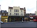
McDonald's, Clapham High Street
An Art Deco building, reused
Image: © David Smith
Taken: 17 Nov 2016
0.01 miles
2
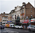
"The Majestic", Clapham
Former cinema built in 1914 as the Majestic Cinema to a design by John Stanley Beard..
Image: © Jim Osley
Taken: 31 Jan 2018
0.01 miles
3

Clapham High Street SW4 (2)
Near Stonhouse Street.
Image: © Danny P Robinson
Taken: 21 Jun 2006
0.01 miles
4
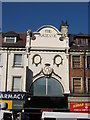
The Majestic 146-152 Clapham High Street
This was built in 1914 as the Majestic Cinema and once boasted its own symphony orchestra It was turned into a Gaumont cinema and inevitably ended life as a bingo hall. It is now a nightclub (http://claphamhighstreet.co.uk/Content/chshistory.htm )
Image: © Richard Rogerson
Taken: 21 Feb 2009
0.01 miles
6
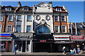
Inferno Night Club, Clapham High Street
Image: © Robin Sones
Taken: 18 Sep 2019
0.02 miles
8
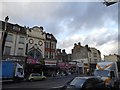
The former Majestic cinema, Clapham High Street
Built in 1914, now a nightclub, Inferno
Image: © David Smith
Taken: 17 Nov 2016
0.02 miles
9

London Transport RTW156, Clapham High Street ? 1966
The RTW (W = wide) was the 8 ft wide version of the standard RT, and was built by Leyland Motors as a special version of their Titan PD2 model to suit LT standards. Seen here on driver training duties.
This is one of a series of views featuring buses in the 60s, 70s, and 80s.
http://www.geograph.org.uk/search.php?i=2114547&displayclass=slide
The scene had changed surprisingly little by the early 20th century https://www.geograph.org.uk/photo/5200461 https://www.geograph.org.uk/photo/5200481 although Tesco is now McDonald's and Lilley & Skinner (a national shoe chain) is now a barber's shop.
Image: © Alan Murray-Rust
Taken: 12 Sep 1966
0.03 miles