
IMAGES TAKEN NEAR TO
Tremadoc Road, LONDON, SW4 7NA
Introduction
This page details the photographs taken nearby to Tremadoc Road, SW4 7NA by members of the Geograph project.
The Geograph project started in 2005 with the aim of publishing, organising and preserving representative images for every square kilometre of Great Britain, Ireland and the Isle of Man.

There are currently over 7.5m images from over14,400 individuals and you can help contribute to the project by visiting https://www.geograph.org.uk
Image Map
Images are licensed for reuse under creativecommons.org/licenses/by-sa/2.0
Notes
- Clicking on the map will re-center to the selected point.
- The higher the marker number, the further away the image location is from the centre of the postcode.
Image Listing (187 Images Found)
Images are licensed for reuse under creativecommons.org/licenses/by-sa/2.0
Image
Details
Distance
1
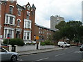
Bedford Road SW4 (3)
Looking towards the junction with Sandmere Road.
Image: © Danny P Robinson
Taken: 15 Aug 2006
0.03 miles
2
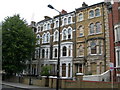
Bedford Road SW4 (2)
Showing, on the right, number 63 which is Grade 2 listed.
Image: © Danny P Robinson
Taken: 15 Aug 2006
0.04 miles
3
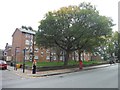
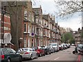
London : Lambeth - Bedford Road
Bedford Road and a block of apartments beside it.
Image: © Lewis Clarke
Taken: 26 Oct 2014
0.04 miles
4
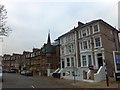
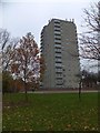
House with a spire, Haselrigge Road, SW4
A mixture of housing styles in this residential road off Bedford Road
Image: © David Smith
Taken: 28 Nov 2013
0.05 miles
6
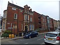
Old and new housing in Ferndale Road, Clapham
The building on the left, on the corner with Bedford Road, names Ferndale Road twice. Once, with a conventional black and white council sign, once with a plasterwork panel.
Image: © David Smith
Taken: 28 Nov 2013
0.09 miles
8
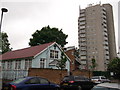
The Bible Truth of God Church, Clapham
On Hetherington Road.
In the background a towerblock of housing on Solon New Road.
Image: © David Anstiss
Taken: 3 Jun 2012
0.11 miles
9
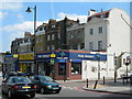
Clapham High Street SW4 (1)
Corner of Aristotle Road. One of the shops was evidently a record and piano-roll shop once. See link for close up http://www.geograph.org.uk/photo/189844
Image: © Danny P Robinson
Taken: 21 Jun 2006
0.12 miles
10
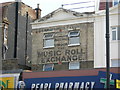
The Music Roll Exchange
This is a close up of the painted sign on the shop on Clapham High Street. A reminder of an age when home entertainment came in a different form. Click this link for a view of the shop itself. http://www.geograph.org.uk/photo/189837 The wall has now been repainted and this advertisement is no longer visible.
Image: © Danny P Robinson
Taken: 21 Jun 2006
0.12 miles